- Usage in publication:
-
- Sais quartzite
- Modifications:
-
- Named
- Dominant lithology:
-
- Quartzite
- AAPG geologic province:
-
- Orogrande basin
Summary:
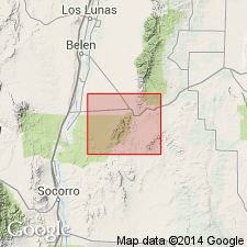
Named for Santa Fe railway station near Abo Pass in southeasternmost Valencia Co, NM. No type locality designated. Occurs as a belt, ranging from less than 500 ft to about 1000 ft wide, extending from north of Abo Pass southward along east flank of Los Pinos Mountains for about 5 miles in northeastern Socorro Co, NM in Orogrande basin. Varies from light to dark gray with greenish and nearly white facies in a few outcrops. Grain size rarely larger than 1 mm in diameter. Massive quartzose beds 3 to 5 ft thick alternate with thinner-bedded zones, commonly sericitic. Greatest thickness, about 600 ft, occurs at Abo Pass. Is oldest pre-Cambrian unit in study area. Conformably underlies pre-Cambrian Blue Springs schist (new). Geologic map. Measured stratigraphic cross sections. Structure cross sections. Pre-Cambrian age [presumably based on regional geology and stratigraphic position].
Source: GNU records (USGS DDS-6; Denver GNULEX).
For more information, please contact Nancy Stamm, Geologic Names Committee Secretary.
Asterisk (*) indicates published by U.S. Geological Survey authors.
"No current usage" (†) implies that a name has been abandoned or has fallen into disuse. Former usage and, if known, replacement name given in parentheses ( ).
Slash (/) indicates name conflicts with nomenclatural guidelines (CSN, 1933; ACSN, 1961, 1970; NACSN, 1983, 2005, 2021). May be explained within brackets ([ ]).

