The National Geologic Map Database is migrating to a new infrastructure. We apologize for any service disruptions during this process.
|
|---|


- Usage in publication:
-
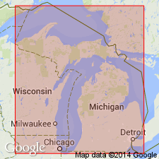
- Saginaw formation
- Modifications:
-
- Named
- Dominant lithology:
-
- Coal
- Clay
- Shale
- Sandstone
- AAPG geologic province:
-
- Michigan basin
Summary:
Named the Saginaw formation for the Saginaw Valley and Saginaw Co., southern MI. Consists of coal, paving brick clay, shale, and sandstone. Overlies Grand Rapids group. Unit is equivalent to Pottsville formation. The Saginaw is of Pennsylvanian age.
Source: GNU records (USGS DDS-6; Reston GNULEX).
- Usage in publication:
-
- Saginaw group
- Modifications:
-
- Revised
- AAPG geologic province:
-
- Michigan basin
Summary:
Revised the Saginaw to the Saginaw group. Unit is composed of material of fresh water, brackish water, and marine origin, and consists of sandstone, shale, coal, and limestone. Comprises many cyclical formations, one which (Verne formation) contains a persistent shaly marine limestone member that makes it convenient to divide the group into pre- and post-Verne cyclical formations. Thickness of group is 400 feet. Overlies the Parma sandstone wherever that formation is present; in some areas, directly overlies the Bayport formation, as in area immediately north of Jackson; in several localities, may rest directly on Napoleon sandstone. Underlies Grand River group. The Saginaw is of Pennsylvanian age.
Source: GNU records (USGS DDS-6; Reston GNULEX).
For more information, please contact Nancy Stamm, Geologic Names Committee Secretary.
Asterisk (*) indicates published by U.S. Geological Survey authors.
"No current usage" (†) implies that a name has been abandoned or has fallen into disuse. Former usage and, if known, replacement name given in parentheses ( ).
Slash (/) indicates name conflicts with nomenclatural guidelines (CSN, 1933; ACSN, 1961, 1970; NACSN, 1983, 2005, 2021). May be explained within brackets ([ ]).