The National Geologic Map Database is migrating to a new infrastructure. We apologize for any service disruptions during this process.
|
|---|


- Usage in publication:
-
- Saddle Mountain Formation
- Modifications:
-
- Revised
- AAPG geologic province:
-
- South Oklahoma folded belt
Summary:
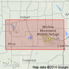
Study area is within Wichita Mountains, southwestern Oklahoma (S. Oklahoma folded belt province). /Wichita Granite Group provisionally revised, from consisting of 5 units (Mount Scott, Headquarters, Reformatory, Lugert, and Quanah) to 10 units (with the addition of Cache, Cooperton, Long Mountain, Medicine Park, and Saddle Mountain). Wichita igneous province divided into eastern and western provinces. Eastern province contains largest area of outcrop, but most of existing nomenclature originated in western part. In the eastern province, the Wichita Granite Group (revised) consists of: Mount Scott Granite, Saddle Mountain Formation, Medicine Park Formation, Cache Formation, and Quanah Granite. In the western province, the Wichita consists of: Mount Scott Granite, Headquarters Granite, Reformatory Granite, Long Mountain Formation, Cooperton Formation, and Lugert Granite. Wichita Granite Group is intrusive equivalent of /Carlton Rhyolite Group. Age of Wichita is Middle Cambrian (525 +/-25 m.y.). Report includes geochemistry, stratigraphic table, map showing distribution of units.
Saddle Mountain Formation removed from Carlton Rhyolite Group because unit can be traced changing gradually from a unit with extrusive characteristics to one with intrusive characteristics, very similar to Mount Scott Granite; Saddle Mountain is a possible differentiate of Mount Scott that partially extruded up through sill roof. Can be mapped as far south as sec. 7, T. 4 N., R. 14 W.
[Wichita Granite Group preempted by Wichita [Group] of Cummins (1890) in TX; conflicts with nomenclature guidelines stating a group name combines a geographic name with the term "group," and no lithic designation is included (ACSN, 1961, 1970; NACSN, 1983, 2005, 2021).]
Source: Modified from GNU records (USGS DDS-6; Denver GNULEX).
For more information, please contact Nancy Stamm, Geologic Names Committee Secretary.
Asterisk (*) indicates published by U.S. Geological Survey authors.
"No current usage" (†) implies that a name has been abandoned or has fallen into disuse. Former usage and, if known, replacement name given in parentheses ( ).
Slash (/) indicates name conflicts with nomenclatural guidelines (CSN, 1933; ACSN, 1961, 1970; NACSN, 1983, 2005, 2021). May be explained within brackets ([ ]).