The National Geologic Map Database is migrating to a new infrastructure. We apologize for any service disruptions during this process.
|
|---|


- Usage in publication:
-
- Sacagawea Ridge Till*
- Sacagawea Ridge Glaciation*
- Modifications:
-
- Named
- Dominant lithology:
-
- Till
- AAPG geologic province:
-
- Wind River basin
Summary:
Pg. D132-D136. Name Sacagawea Ridge Till applied to middle of three pre-Bull Lake tills. Thickness of till 65 to 81 feet at type section where it underlies Dinwoody Lake Till and overlies conglomerate of Tertiary age; 30 feet thick on Cedar Ridge. Disconformably overlies Cedar Ridge Till (new); disconformably underlies Dinwoody Lake Till (new). The three tills may be equivalent to Rocky Flats Alluvium (oldest), Verdos Alluvium, and Slocum Alluvium of Denver basin, which in turn are correlated with Nebraskan, Kansas, and Illinoian Glaciations of midcontinent region. For purposes of correlation in Rocky Mountain region, terms Cedar Ridge Glaciation, Sacagawea Ridge Glaciation, and Dinwoody Lake Glaciation are proposed from type localities of their respective tills.
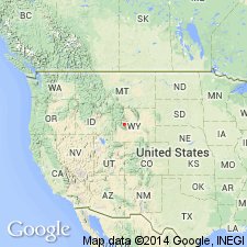
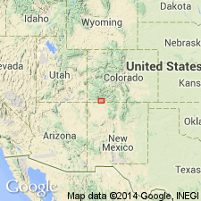
Type section: Sacagawea Ridge on north side of Upper Dinwoody Lake, in center sec. 31, T. 5 N., R. 5 W., [north flank of Wind River Mountains], Fremont Co., WY.
Source: US geologic names lexicon (USGS Bull. 1350, p. 650).
- Usage in publication:
-
- Sacagawea Ridge Till*
- Sacagawea Ridge Glaciation*
- Modifications:
-
- Areal extent
- AAPG geologic province:
-
- Wind River basin
Summary:
Pg. C137-C143. Quaternary stratigraphy of Durango area, San Juan Mountains, Colorado. End moraine of type Durango Till (Atwood and Mather, 1932, USGS Prof. Paper 166). Some of Atwood and Mather's (1932, USGS Prof. Paper 166) Durango moraines are of Bull Lake age, but their type Durango moraine represents the youngest of the three pre-Bull Lake glaciations, the Sacagawea Ridge Glaciation. Florida Gravel is outwash of Sacagawea Ridge age and may represent two glacial advances.
Source: US geologic names lexicon (USGS Bull. 1350, p. 650).
For more information, please contact Nancy Stamm, Geologic Names Committee Secretary.
Asterisk (*) indicates published by U.S. Geological Survey authors.
"No current usage" (†) implies that a name has been abandoned or has fallen into disuse. Former usage and, if known, replacement name given in parentheses ( ).
Slash (/) indicates name conflicts with nomenclatural guidelines (CSN, 1933; ACSN, 1961, 1970; NACSN, 1983, 2005, 2021). May be explained within brackets ([ ]).