- Usage in publication:
-
- Russell Mountain Formation*
- Modifications:
-
- Named
- Dominant lithology:
-
- Granulite
- Quartzite
- AAPG geologic province:
-
- New England province
Summary:
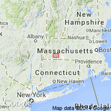
Named for Russell Mountain, Woronoco quad, southwestern MA. Exposures found in Woronoco quad include along Massachusetts Turnpike, in north-south series of outcrops on Russell Mountain between Massachusetts Turnpike and Little River, in a group of outcrops about 1000 ft south of Little River on northeast end of Westfield Mountain, and on Ball Mountain. Exposures in adjacent Blandford quad are found in center of racetrack at fairground in village of Blandford. Consists of greenish-gray, medium-grained, generally massive, locally compositionally banded calc-silicate granulite with some instances of carbonate-calc-silicate rock; and white, very light-gray, or light-brown, quartzite. Rocks are interbedded in varying proportions. Thickness is no more than 70 ft at type locality, but ranges from 0 to 110 ft. Upper contact with Goshen Formation is sharp and bedding in both formations is parallel with no evidence of an unconformity; sharp lower contact with schists and gneisses intertonguing with Hawley Formation. Report includes small geologic map. Rock is unfossiliferous. Believed to be lateral equivalent of Shaw Mountain Formation of eastern VT on basis of similar lithologies and stratigraphic position. On this basis, Russell Mountain Formation is assigned Middle Silurian (Wenlock) age.
Source: GNU records (USGS DDS-6; Reston GNULEX).

- Usage in publication:
-
- Russell Mountain Formation*
- Modifications:
-
- Overview
- AAPG geologic province:
-
- New England province
Summary:
Used as Russell Mountain Formation of Silurian age. Consists of granofels and marble. Correlated with fossiliferous Shaw Mountain Formation of eastern VT.
Source: GNU records (USGS DDS-6; Reston GNULEX).

- Usage in publication:
-
- Russell Mountain Formation*
- Modifications:
-
- Overview
- Areal extent
- AAPG geologic province:
-
- New England province
Summary:
In original definition of Russell Mountain Formation (Hatch and others (1970), calcareous granofels on Woronoco dome was included in unit. Subsequent mapping by Stanley and others (1982) indicates that rocks mapped on Woronoco dome are different from the rest of Russell Mountain Formation and are more logically included in overlying Lower Devonian sequence (mapped as an unnamed member of Goshen Formation in fig. 3). Other than this modification and mapping a few lenses of Russell Mountain Formation just north of Massachusetts Turnpike, original definition of Russell Mountain stands. Thickness does not exceed 35 m, but its correlative in CT, the basal member of The Straits Schist of Rodgers (1982, 1985), is locally at least twice as thick. Has not been shown to correlate with either Clough Quartzite or Fitch Formation to the east. Russell Mountain Formation is highly discontinuous except near Shelburne Falls dome. Locally overlies members A and D of Cobble Mountain Formation; overlain everywhere by Goshen Formation. Silurian age is based on correlation with discontinuous lenses of similar rocks at same stratigraphic position as Shaw Mountain Formation of VT. Recent field trips with J.B. Thompson, Jr. (Harvard University) and others has raised questions as to whether many of those rocks in southern VT are actually Shaw Mountain. Shaw Mountain Formation has been assigned a firm age of late Llandoverian to Gedinnian north of Albany, VT, based on HOWELLELA (Boucot and Thompson, 1963; Konig, 1961). [Age in this report is Silurian only. Papers presented as chapters in U.S. Geological Survey Professional Paper 1366 are intended as explanations and (or) revisions to MA State bedrock geologic map of Zen and others (1983) at scale of 1:250,000.]
Source: GNU records (USGS DDS-6; Reston GNULEX).
For more information, please contact Nancy Stamm, Geologic Names Committee Secretary.
Asterisk (*) indicates published by U.S. Geological Survey authors.
"No current usage" (†) implies that a name has been abandoned or has fallen into disuse. Former usage and, if known, replacement name given in parentheses ( ).
Slash (/) indicates name conflicts with nomenclatural guidelines (CSN, 1933; ACSN, 1961, 1970; NACSN, 1983, 2005, 2021). May be explained within brackets ([ ]).

