- Usage in publication:
-
- Rugg Brook dolomite conglomerate
- Modifications:
-
- Original reference
- Dominant lithology:
-
- Dolomite
- Conglomerate
- AAPG geologic province:
-
- New England province
Summary:
Pg. 856, 359, 365, 366, 368, etc. Rugg Brook dolomite conglomerate. The Middle Cambrian of northwestern Vermont consists of St. Albans slate and its basal Rugg Brook dolomite conglomerate, which Keith thinks should be regarded as a separate formation. Thickness of this conglomerate is 0 to 20 feet. It unconformably overlies Parker slate (Lower Cambrian). The St. Albans slate is underlain basally in at least 3 places by the Rugg Brook dolomite conglomerate, which weathers salmon yellow and is usually less than 20 feet thick. These 3 localities are on Rugg Brook, on Conner's farm, and near Rockledge. The dolomite blocks, up to 2 feet across, are out of either Parker or the Mallett formation, and rarely there are also pieces of Winooski red dolomite. The paste is the usual round-grained sand cemented by dolomite. No fossils known in Rugg Brook conglomerate but St. Albans slate contains Middle Cambrian fossils.
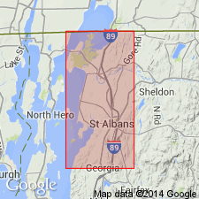
Type locality: on Rugg Brook, less than 3 mi southwest of St. Albans, [St. Albans 15-min quadrangle], Franklin Co., northwestern VT.
[GNC remark (ca. 1936, US geologic names lexicon, USGS Bull. 896, p. 1854): Keith correlated his Clarendon Springs dolomite (Lower Cambrian) with his so-called Milton dolomite, which Schuchert has renamed Rugg Brook dolomite conglomerate and assigned to Middle Cambrian. If this correlation is correct, the Rugg Brook conglomerate may be Lower Cambrian or the Clarendon Springs dolomite may be Middle Cambrian.]
Source: US geologic names lexicon (USGS Bull. 896, p. 1854).
For more information, please contact Nancy Stamm, Geologic Names Committee Secretary.
Asterisk (*) indicates published by U.S. Geological Survey authors.
"No current usage" (†) implies that a name has been abandoned or has fallen into disuse. Former usage and, if known, replacement name given in parentheses ( ).
Slash (/) indicates name conflicts with nomenclatural guidelines (CSN, 1933; ACSN, 1961, 1970; NACSN, 1983, 2005, 2021). May be explained within brackets ([ ]).

