

- Usage in publication:
-
- Royer marble*
- Modifications:
-
- Original reference
- Dominant lithology:
-
- Marble
Summary:
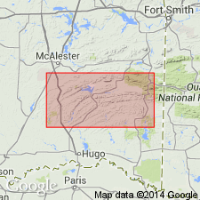
Pg. 28. Royer marble. Marine deposition in Arbuckle uplift began with Reagan sandstone, and Upper Cambrian formation with abundant fauna. Over this comes Royer marble, a previously unnamed Lower Ozarkian formation, about 500 feet thick, that was included by Taff in basal part of his great Arbuckle limestone. The fauna found in this formation invaded from west of Rocky Mountains by way of Marathon basin of western Texas. Neither Middle nor Upper Ozarkian deposits occur in Oklahoma. The remainder of Taff's Arbuckle limestone is assigned to Canadian Period. It includes Lower, Middle, and Upper Canadian.
Source: US geologic names lexicon (USGS Bull. 896, p. 1852).
For more information, please contact Nancy Stamm, Geologic Names Committee Secretary.
Asterisk (*) indicates published by U.S. Geological Survey authors.
"No current usage" (†) implies that a name has been abandoned or has fallen into disuse. Former usage and, if known, replacement name given in parentheses ( ).
Slash (/) indicates name conflicts with nomenclatural guidelines (CSN, 1933; ACSN, 1961, 1970; NACSN, 1983, 2005, 2021). May be explained within brackets ([ ]).