- Usage in publication:
-
- Rough Mountain conglomerate lentil
- Modifications:
-
- First used
- Dominant lithology:
-
- Conglomerate
- AAPG geologic province:
-
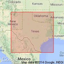
- Llano uplift
Summary:
First used as "Rough Mountain conglomerate lentil" of the "Brownwood shale member" of Canyon group [ranks incorrect; Brownwood is not assigned to a formation, which it should be, and conglomerate lentil is a rank equivalent to shale member]. Probably named for Rough Mountain, McCulloch Co, TX on Llano uplift [though this is not stated]. No type locality designated. It is a small lentil, which extends from the point where Rochelle-Cowboy road leaves Rochelle-San Saba road, north about 3 mi. The conglomerate very closely resembles Rochelle conglomerate, and undoubtedly was derived from the same source. Is made up of the same subangular chert pebbles but is somewhat coarser and has a greater maximum thickness and less extent. Thickness of Rough Mountain varies more than Rochelle; the range is from 6-20 ft. On east side of Rough Mountain, where it is 20 ft thick, the section consists of alternating beds of gravel and coarse sand exhibiting cross bedding like that found in stream terraces. The foreset beds dip southwest 10-30 degrees. West and north from Rough Mountain the conglomerate thins, and finally grades into coarse-grained, cross-bedded sandstone 1 mi west and 1/2 mi north of east side of Rough Mountain. The lentil probably originated as an alluvial fan or apron washed out onto a nearly flat coastal plain by a stream heading far eastward to regions dominated by novaculites and other chert-bearing formations. Pennsylvanian in age.
Source: GNU records (USGS DDS-6; Denver GNULEX).
For more information, please contact Nancy Stamm, Geologic Names Committee Secretary.
Asterisk (*) indicates published by U.S. Geological Survey authors.
"No current usage" (†) implies that a name has been abandoned or has fallen into disuse. Former usage and, if known, replacement name given in parentheses ( ).
Slash (/) indicates name conflicts with nomenclatural guidelines (CSN, 1933; ACSN, 1961, 1970; NACSN, 1983, 2005, 2021). May be explained within brackets ([ ]).

