

- Usage in publication:
-
- Ross limestone
- [Ross Fork limestone*]
- Modifications:
-
- Original reference
- Biostratigraphic dating
- Dominant lithology:
-
- Limestone
- Shale
- AAPG geologic province:
-
- Snake River basin
Summary:
Pg. 33, 35; Washington Acad. Sci. Jour., v. 5, p. 492, 1915. Ross [Ross Fork] limestone of Thaynes group. Consists of (descending): (1) 500+/- feet of dense calcareous shale, gray to olive greenish, weathering brown to yellow; (2) 800+/- feet of massively bedded and thin-bedded gray to brown limestones with large numbers of small brachiopods (chiefly PUGNAX and terebratuloids) and pelecypods (MYALINA) with intervening shales; (3) MEEKOCERAS zone, consisting of 50 feet of gray to reddish-brown limestones. Thickness of formation 1,350+/- feet. Is basal formation of Thaynes group in Fort Hall Indian Reservation. Conformably underlies Fort Hall formation and conformably overlies Woodside shale. [Fossils (brachiopods, pelecypods, ammonites, gastropods) listed, identified by G.H. Girty, USGS, see p. 35-37. Notable ammonites MEEKOCERAS MUCHBACHANUM, MEEKOCERAS GRACILITATIS, PARANANNITES ASPENENSIS, OPHICERAS DIENERI, FLEMINGITES RUSSELLI, CLYPITES TENUIS.] Age is Early Triassic.
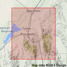
Named from Ross Fork Creek, in upper waters of which it is well exposed, [Bingham Co.], ID.
Source: Publication; US geologic names lexicon (USGS Bull. 896, p. 755-756).
- Usage in publication:
-
- Ross Fork limestone*
- Ross limestone†
- Modifications:
-
- Redescribed
- AAPG geologic province:
-
- Snake River basin
Summary:
Pg. 46, and USGS Bull. 716, p. 128. Ross Fork limestone, previously described under name Ross limestone [preoccupied by a Lower Devonian limestone in Tennessee.]
Source: US geologic names lexicon (USGS Bull. 896, p. 1846).
- Usage in publication:
-
- Ross Fork limestone*
- Modifications:
-
- Areal extent
- AAPG geologic province:
-
- Snake River basin
- Wasatch uplift
Summary:
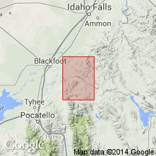
Pg. 17, 31-32, pl. 1. Ross Fork limestone of Thaynes group. Mapped in Ammon and Paradise Valley quadrangles where it consists of grayish and yellowish limestone, shale, and sandstone. Age is Early Triassic.
Source: US geologic names lexicon (USGS Bull. 1200, p. 3342).
- Usage in publication:
-
- Ross Fork limestone
- Modifications:
-
- Not used
Summary:
Thaynes assigned formation rank in report area. Portneuf is a distinctive limestone that can be traced from Fort Hall, ID to Cumberland, WY. The Ross Fork and the Fort Hall (formerly Ross Fork limestone and Fort Hall formation of Thaynes group) loose their identity and are of limited distribution. Names Ross Fork and Fort Hall not used.
Source: GNU records (USGS DDS-6; Denver GNULEX).
- Usage in publication:
-
- Ross Fork Limestone Member*
- Modifications:
-
- Revised
- Overview
- AAPG geologic province:
-
- Snake River basin
Summary:
Is the lower member of the Thaynes Formation. Overlies Dinwoody Formation and underlies Fort Hall Member, middle member of the Thaynes. Both the Ross Fork and the Fort Hall were formerly considered to be of formation rank. Consists of 1,700 ft of limestone and shale. The basal part --two gray limestone layers 10-30 ft thick are separated by 12-15 ft of shale. MEEKOCERAS commonly found in the lower limestone. The main part of the member is thin-bedded to platy, tan-weathering shale or siltstone and silty limestone containing some gray to dark gray limestone. The uppermost bed (less than 1 inch thick) is tan, thin-bedded to platy, silty, gray-weathering limestone. Mapped (geologic map) in central and southeast part of quad. in Bannock and Bingham Cos., ID in the Snake River basin. Assigned to the Lower Triassic.
Source: GNU records (USGS DDS-6; Denver GNULEX).
For more information, please contact Nancy Stamm, Geologic Names Committee Secretary.
Asterisk (*) indicates published by U.S. Geological Survey authors.
"No current usage" (†) implies that a name has been abandoned or has fallen into disuse. Former usage and, if known, replacement name given in parentheses ( ).
Slash (/) indicates name conflicts with nomenclatural guidelines (CSN, 1933; ACSN, 1961, 1970; NACSN, 1983, 2005, 2021). May be explained within brackets ([ ]).