

- Usage in publication:
-
- Roseburg Formation
- Modifications:
-
- Named
- Biostratigraphic dating
- Dominant lithology:
-
- Basalt
- Limestone
- AAPG geologic province:
-
- Oregon-Washington Coast Ranges province
- Klamath Mountains province
Summary:
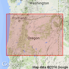
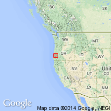
Named for town of Roseburg. Includes all of basalt and interbedded sedimentary rocks along North Fork of Umpqua River between Frear Bridge, 3 mi west of Glide to its confluence with South Fork and in Red Hill anticline along U.S. HWY I-5 from Turkey Hill to center of syncline along Calapooya Creek near Oakland, OR. Mapped as "lower Umpqua" by Baldwin (1965, 1969). Thick section in lower part is equivalent in age to Siletz River Volcanics. Names "Wilbur tuff lentil" and "Oakland Limestone Lentil" of Diller (1898) are abandoned as formal units within Roseburg. Basalt and post-basalt section may be 12,000 to 15,000 ft thick. Unconformably overlies Cretaceous or earlier rocks. Unconformably underlies Lookingglass Formation (new). Age is Paleocene and early Eocene based on palynomorphs (Paleocene) identified by D.W. Engelhardt (written commun., 1972) and early Eocene microfauna of Penutian Stage (Baldwin, 1969). Shown on geologic map of southwest OR and in cross sections with marine basalts indicated separately.
Source: GNU records (USGS DDS-6; Menlo GNULEX).

- Usage in publication:
-
- Roseburg Formation
- Modifications:
-
- Revised
- AAPG geologic province:
-
- Oregon-Washington Coast Ranges province
- Klamath Mountains province
Summary:
Included as lowermost formation (of 3) of Umpqua Group. [Author discusses reasons for raising rank of Umpqua.] Shown in stratigraphic columns at Middle Fork, Coquille River and at North Umpqua River, OR. Interfingers with and overlies Siletz River Formation. Underlies Bushnell Rock Member of Lookingglass Formation (Umpqua Group). To north of Roseburg in Drain and Anlauf quads, Hoover (1963) described Roseburg Formation with total thickness of 5000 ft between Siletz River and Tyee Formations. (No rocks similar to Lookingglass or Flournoy Formation are known to occur in this area.)
Source: GNU records (USGS DDS-6; Menlo GNULEX).
- Usage in publication:
-
- Roseburg Formation
- Modifications:
-
- Not used
- AAPG geologic province:
-
- Oregon-Washington Coast Ranges province
- Klamath Mountains province
Summary:
Basaltic rocks of Roseburg Formation (Baldwin, 1974) are assigned to Siletz River Volcanics. Sedimentary rocks of Roseburg (8000 ft thick which overlie basalt) are correlated in part with Tenmile Member of Umpqua Formation. Roseburg, Lookingglass, and Flournoy Formations of Umpqua "Group" are not recognized. Umpqua Formation is retained as consisting of sedimentary rocks with following members (ascending): Bushnell Rock, Tenmile, White Tail Ridge, and Camas Valley Members. [members are not adopted in this paper]
Source: GNU records (USGS DDS-6; Menlo GNULEX).
For more information, please contact Nancy Stamm, Geologic Names Committee Secretary.
Asterisk (*) indicates published by U.S. Geological Survey authors.
"No current usage" (†) implies that a name has been abandoned or has fallen into disuse. Former usage and, if known, replacement name given in parentheses ( ).
Slash (/) indicates name conflicts with nomenclatural guidelines (CSN, 1933; ACSN, 1961, 1970; NACSN, 1983, 2005, 2021). May be explained within brackets ([ ]).