- Usage in publication:
-
- Rosebud Member
- Modifications:
-
- Named
- Dominant lithology:
-
- Mudstone
- AAPG geologic province:
-
- Snake River basin
Summary:
Pg. 61, pls. 1, 3. Rosebud Member, lowermost member (of 3) of Trowbridge Formation. Dominantly hard, faintly laminated, dark mudstone with characteristic pencil fracture. Two horizons of ellipsoidal calcareous concretions, each 1 to 3 feet in diameter, occur 20 to 40 feet above base in type locality. Thickness 400 to 500 feet except southwest of Sheep Creek, where it is progressively onlapped by overlying Officer Member (new). Unconformably overlies Snowshoe Formation. Age is Late Jurassic (Callovian).
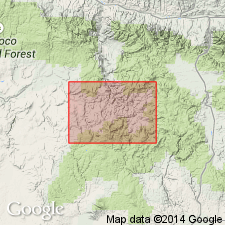
Type locality: in type area of Trowbridge Formation on spur along line between SW/4 sec. 28 and SE/4 sec. 29, T. 17 S., R. 28 E., in vicinity of Rosebud Creek, Suplee-Izee area, Grant Co., OR. Named from Rosebud Creek.
Source: US geologic names lexicon (USGS Bull. 1350, p. 643); supplemental information from GNU records (USGS DDS-6; Menlo GNULEX).
For more information, please contact Nancy Stamm, Geologic Names Committee Secretary.
Asterisk (*) indicates published by U.S. Geological Survey authors.
"No current usage" (†) implies that a name has been abandoned or has fallen into disuse. Former usage and, if known, replacement name given in parentheses ( ).
Slash (/) indicates name conflicts with nomenclatural guidelines (CSN, 1933; ACSN, 1961, 1970; NACSN, 1983, 2005, 2021). May be explained within brackets ([ ]).

