The National Geologic Map Database is migrating to a new infrastructure. We apologize for any service disruptions during this process.
|
|---|


- Usage in publication:
-
- Rosebud Formation
- Modifications:
-
- Contact revised
- AAPG geologic province:
-
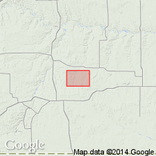
- Sioux uplift
Summary:
Upper contact revised in Millette Co, SD on the Sioux uplift. Thin Elk Formation, a new formation of Ogallala Group above Rosebud Formation named. [Not clearly stated as to whether underlying Rosebud Formation is also part of Ogallala.] Thin Elk is a stream deposit that cut down into the Rosebud. The Thin Elk-Rosebud contact chosen at lithologic change from yellowish to brownish sand and gravel of Thin Elk to pink silt of Rosebud. Of early middle Miocene age.
Source: GNU records (USGS DDS-6; Denver GNULEX).
For more information, please contact Nancy Stamm, Geologic Names Committee Secretary.
Asterisk (*) indicates published by U.S. Geological Survey authors.
"No current usage" (†) implies that a name has been abandoned or has fallen into disuse. Former usage and, if known, replacement name given in parentheses ( ).
Slash (/) indicates name conflicts with nomenclatural guidelines (CSN, 1933; ACSN, 1961, 1970; NACSN, 1983, 2005, 2021). May be explained within brackets ([ ]).