

- Usage in publication:
-
- Rose Hill formation
- Modifications:
-
- Named
- Dominant lithology:
-
- Shale
- Sandstone
- AAPG geologic province:
-
- Appalachian basin
Summary:
Named the Rose Hill formation for Rose Hill, Cumberland, MD. Unit is used for pre-Rochester part of Clinton group of MD. Consists of 300 to 550 ft of fossiliferous shale interbedded with subordinate amounts of thin argillaceous sandstone and a few bands of limestone; the shale is argillaceous, thin-bedded, fissile, of drab or olive color, but with pink or reddish beds in upper part. Comprises all beds in MD between top of Tuscarora formation and base of Keefer sandstone, and is divisible into (1) upper shale beds with some purplish bands and some thin limestones, (2) Cresaptown iron sandstone, 10 to 30 ft thick, and (3) lower shale and sandstone beds, 175 ft thick. Considered of Middle Silurian age.
Source: GNU records (USGS DDS-6; Reston GNULEX).
- Usage in publication:
-
- Rose Hill Formation
- Modifications:
-
- Areal extent
- AAPG geologic province:
-
- Appalachian basin
Summary:
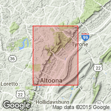
Name Rose Hill has been applied throughout central PA and southwestward through MD, northern VA, and WV to eastern TN. Much of the Rose Hill is medium-dark-gray shale which weathers to light olive, but near the top, the beds become brownish or yellowish-brown. Near the top occur thin- and very thin bedded of calcareous siltstone and numerous thin beds of densely fossiliferous limestone. Fossils include brachiopods, ostracodes, trilobites, and tentaculitids. Contact with underlying Tuscarora Formation is probably conformable. Upper contact with Keefer Formation is gradational over 1 m, changing from interbedded shale and calcareous siltstone to fossiliferous hematitic limestone and sandstone. Thickness of 285+/-50 m is calculated from dip and map-pattern width. Most complete exposure occurs in the Frankstown quad at the south end of Canoe Mountain along a dirt road through the woods north of U.S. Rte 22. Age is Early Silurian.
Source: GNU records (USGS DDS-6; Reston GNULEX).
For more information, please contact Nancy Stamm, Geologic Names Committee Secretary.
Asterisk (*) indicates published by U.S. Geological Survey authors.
"No current usage" (†) implies that a name has been abandoned or has fallen into disuse. Former usage and, if known, replacement name given in parentheses ( ).
Slash (/) indicates name conflicts with nomenclatural guidelines (CSN, 1933; ACSN, 1961, 1970; NACSN, 1983, 2005, 2021). May be explained within brackets ([ ]).