- Usage in publication:
-
- Ropes Creek Amphibolite
- Modifications:
-
- Named
- Dominant lithology:
-
- Amphibolite
- AAPG geologic province:
-
- Piedmont-Blue Ridge province
Summary:
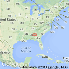
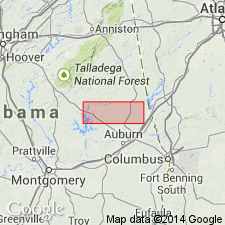
Most prominent rock unit of the Dadeville Complex, a delicately layered amphibolite, is named for excellent exposures along Ropes Creek, Lee Co., AL. The Ropes Creek Amphibolite crops out over nearly 40 percent of the Complex and is the dominant lithology in the southern area. The amphibolite is composed of hornblende and plagioclase with accessory augite, biotite, garnet, epidote, quartz, sphene, and apatite. Unit has been traced eastward into GA and mapped over the lower part of Chambers Co., AL. Becomes infolded with the Camp Hill granite and gneiss to the east. Northward appears to be of lesser metamorphic grade.
Source: GNU records (USGS DDS-6; Reston GNULEX).

- Usage in publication:
-
- Ropes Creek Metabasalt*
- Modifications:
-
- Revised
- AAPG geologic province:
-
- Piedmont-Blue Ridge province
Summary:
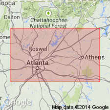
The Ropes Creek Amphibolite of Bentley and Neathery (1970) is here revised and accepted by the USGS as the Ropes Creek Metabasalt in the Ropes Creek thrust sheet in AL and GA. It includes the Cedar Lake Member, the Cherokee alteration zone, formerly the Canton Schist of Bayley (1928), which consists of pelagic manganiferous schists and metavolcanic chemical sediments, and various mappable volcanogenic alteration zones and iron-formations. Informal named units assigned to the Ropes Creek include the Mitchell Dam and Beaverdam amphibolites and parts of the Ketchepedrakee and Doss Mountain amphibolites and Hillabee greenstone in AL; and the Slaughters metagabbro and parts of the Pumpkinvine Creek Formation and Lost Mountain Amphibolite and Rose Creek Schist Members of the Univeter Formation in GA. It is composed of ochre-weathering, massive to finely layered, locally pillowed, chloritic, magnetite- or pyrite-bearing amphibolites and minor granofels. Iron-rich, siliceous, manganiferous metasediments are distinctive. Age is mostly Cambrian.
Source: GNU records (USGS DDS-6; Reston GNULEX).

- Usage in publication:
-
- Ropes Creek Amphibolite
- Modifications:
-
- Overview
- Revised
- AAPG geologic province:
-
- Piedmont-Blue Ridge province
Summary:
Type locality of Ropes Creek is actually in northwest, not northeast Lee Co. as given by Bentley and Neathery (1970) and Raymond and others (1988). Authors recognize that rocks previously assigned to Zebulon Formation in Chambers Co., AL, (Sears and others, 1981) are very similar to those of Ropes Creek and choose not to use Zebulon, but assign rocks in question to Ropes Creek. Distribution of Waverly Gneiss versus Ropes Creek Amphibolite becomes arbitrary in the northwest part of mapped area. Units are distinguished on the basis of light-colored saprolite within the Waverly. Agricola Schist is younger, in part, than Ropes Creek.
Source: GNU records (USGS DDS-6; Reston GNULEX).

- Usage in publication:
-
- Ropes Creek Amphibolite*
- Modifications:
-
- Overview
- AAPG geologic province:
-
- Piedmont-Blue Ridge province
Summary:
Inner Piedmont is divided into two groups of rocks, Dadeville and Opelika Complexes (Bentley and Neathery, 1970), divided by Stonewall line. Dadeville Complex consists of Agricola Schist, Waresville Schist, Camp Hill Gneiss, Chattasofka Creek Gneiss, Ropes Creek Amphibolite, Waverly Gneiss, Simmons Crossroads metagranite (informal), and various unnamed mafic and ultramafic intrusive rocks. Opelika Complex consists of Loachapoka Schist, Saugahatchee quartzite, and Auburn Gneiss and schist. Farmville Metagranite intrudes these units. Age of all Inner Piedmont rocks is early Paleozoic. Report includes geologic sketch map.
[Remark reflects usage as published, not as reviewed in draft form. Although GNU review requested informal terms to be inverted, the published version shows that authors did not comply with request. Whatley Mill is misspelled as Whatley Mills in published version; error introduced after GNU review. (GNU records, USGS DDS-6; Reston GNULEX 01/21/94)]
Source: GNU records (USGS DDS-6; Reston GNULEX).

- Usage in publication:
-
- Ropes Creek Metabasalt*
- Modifications:
-
- Age modified
- Revised
- AAPG geologic province:
-
- Piedmont-Blue Ridge province
Summary:
Age of Ropes Creek Metabasalt of the allochthonous assemblage is changed to Late Proterozoic(?) to Middle Ordovician(?) based on a more conservative theory that the allochthonous rocks are 1) probably not older than Late Proterozoic because they are not part of Middle Proterozoic (Grenvillian) basement and 2) they could be as young, but not younger than, the time marking the beginning of closure of the ocean they originated in, as set by the slope reversal marked by deposition of Middle Ordovician Rockmart Slate upon unconformity at top of Upper Cambrian to Middle(?) Ordovician Knox Group and Middle Ordovician Lenoir Limestone. Detailed mapping shows that rocks previously designated as Mableton Amphibolite Member of Powers Ferry Formation of Sandy Springs Group are actually rocks of the Ropes Creek; Mableton is herein abandoned and its rocks reassigned to Ropes Creek (Powers Ferry is removed from Sandy Springs, reduced in rank, and assigned as a member of Stonewall Gneiss). Report includes geologic map and correlation chart.
Source: GNU records (USGS DDS-6; Reston GNULEX).
For more information, please contact Nancy Stamm, Geologic Names Committee Secretary.
Asterisk (*) indicates published by U.S. Geological Survey authors.
"No current usage" (†) implies that a name has been abandoned or has fallen into disuse. Former usage and, if known, replacement name given in parentheses ( ).
Slash (/) indicates name conflicts with nomenclatural guidelines (CSN, 1933; ACSN, 1961, 1970; NACSN, 1983, 2005, 2021). May be explained within brackets ([ ]).

