- Usage in publication:
-
- Root shale*
- Modifications:
-
- Original reference
- Dominant lithology:
-
- Shale
- Limestone
- Sandstone
- Coal
- AAPG geologic province:
-
- Forest City basin
Summary:
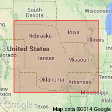
Pg. 2274 (fig. 1), 2275. Root shale of Wabaunsee group. Defined to include strata between Wood Siding formation above and Stotler limestone (new) below. Thickness ranges from about 30 to 90 feet and averages 60 feet. Comprises (ascending) Friedrich shale, Jim Creek limestone, and French Creek shale members. Age is Late Pennsylvanian (Virgilian).
Type section: in roadcut along east-flowing stream near center of N/2 SE/4 sec. 20, T. 21 S., R. 11 E., Lyon Co., east-central KS. Named from Root Station on the Atchison, Topeka, and Santa Fe RR, in SE/4 sec. 23, T. 21 S., R. 11 E., Lyon Co., east-central KS.
Source: US geologic names lexicon (USGS Bull. 1200, p. 3336).
For more information, please contact Nancy Stamm, Geologic Names Committee Secretary.
Asterisk (*) indicates published by U.S. Geological Survey authors.
"No current usage" (†) implies that a name has been abandoned or has fallen into disuse. Former usage and, if known, replacement name given in parentheses ( ).
Slash (/) indicates name conflicts with nomenclatural guidelines (CSN, 1933; ACSN, 1961, 1970; NACSN, 1983, 2005, 2021). May be explained within brackets ([ ]).

