The National Geologic Map Database is migrating to a new infrastructure. We apologize for any service disruptions during this process.
|
|---|


- Usage in publication:
-
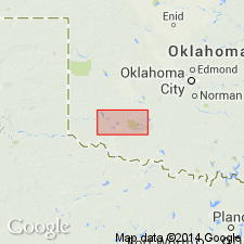
- Roosevelt Gabbros
- Modifications:
-
- Named
- Dominant lithology:
-
- Gabbro
- AAPG geologic province:
-
- South Oklahoma folded belt
Summary:
Named as the upper unit of the Raggedy Mountain Gabbro Group for the town of Roosevelt, Kiowa Co, OK in South Oklahoma folded belt province. No type locality designated. Mapped (geologic map) near Glen Creek in the Glen Mountains of Kiowa Co and near Mt. Sheridan and Mt. Scott in the Wichita Mountains of Comanche Co. Composed of a series of biotite-bearing gabbros that form dikes, sills, and irregular bodies intrusive into the Glen Mountains Layered Complex (new). These gabbros are distinguished from the older feldspathic cumulates of the Glen Mountains Layered Complex by the readily visible biotite. Divided into three newly named members (ascending order): Mount Sheridan (new), Sandy Creek (revised), and Glen Creek (new) Gabbro members. Stratigraphic chart. Stratigraphic sequence of members not clearly stated. Of Cambrian age.
Source: GNU records (USGS DDS-6; Denver GNULEX).
For more information, please contact Nancy Stamm, Geologic Names Committee Secretary.
Asterisk (*) indicates published by U.S. Geological Survey authors.
"No current usage" (†) implies that a name has been abandoned or has fallen into disuse. Former usage and, if known, replacement name given in parentheses ( ).
Slash (/) indicates name conflicts with nomenclatural guidelines (CSN, 1933; ACSN, 1961, 1970; NACSN, 1983, 2005, 2021). May be explained within brackets ([ ]).