The National Geologic Map Database is migrating to a new infrastructure. We apologize for any service disruptions during this process.
|
|---|


- Usage in publication:
-
- Rooney chert member
- Modifications:
-
- Original reference
- Dominant lithology:
-
- Chert
- Limestone
- Shale
- AAPG geologic province:
-
- Montana folded belt
Summary:
Pg. 14, 47, and passim. Rooney chert member of Madison limestone. Shows 3 striking differences when compared with underlying Dean Lake chert: (1) the chert is white; (2) it is usually in form of grossly vesicular nodules which break down to form angular fragments averaging 1. to 1.5 inches diameter; (3) the limestones that form great bulk of the Rooney are always light-colored, in contrast to those forming part of Dean Lake member. Rocks of entire member are massive, generally coarsely crystalline cream-colored limestones interbedded at irregular intervals with thin zones of calcareous buff shale, and with white to white-gray chert disseminated throughout. Thickness 202 to 578 feet. Fossiliferous throughout. Forms upper part and top of higher peak of Lone Butte, where it is well exposed. Age is Mississippian.
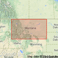
Type locality: on south slope of top of Lone Butte, in SE/4 sec. 23, T. 23 N., R. 13 W., [Amphitheatre Mountain 7.5-min quadrangle (1994 ed.), Flathead Co.], northwestern MT. [Probably named from Rooney Creek, about a mi north of Lone Butte, Amphitheatre Mountain 7.5-min quadrangle (1994 ed.), Flathead Co., northwestern MT.]
Source: US geologic names lexicon (USGS Bull. 896, p. 1842).
- Usage in publication:
-
- Rooney chert member
- Modifications:
-
- Not used
- AAPG geologic province:
-
- Montana folded belt
- Sweetgrass arch
Summary:
Rocks approximately same as Deiss' Dean Lake chert member of Madison limestone are included in unit MB, middle unit of the Mississippian (Osage) of northwestern Montana.
Source: Publication.
- Usage in publication:
-
- Rooney chert
- Modifications:
-
- Revised
- AAPG geologic province:
-
- Montana folded belt
- Sweetgrass arch
Summary:
Pl. 2 (column 38). Rooney chert in Hannan limestone. Shown on correlation chart as being in Hannan limestone. Underlies Monitor Mountain limestone and overlies Dean Lake chert, both in Hannan limestone, Osagean.
Source: US geologic names lexicon (USGS Bull. 1200, p. 3335).
- Usage in publication:
-
- Rooney limestone
- Modifications:
-
- Revised
- AAPG geologic province:
-
- Montana folded belt
Summary:
Pg. 89. Rooney limestone. Hall (1952, unpub. thesis, [Univ. Wisconsin-Madison, 220 p.]) proposed that Deiss' Rooney chert be recognized as a formation and be designated Rooney limestone. The Rooney at type section includes about 550 feet of crinoidal limestone, varying to microcrinoidal or sparsely crinoidal in lower part, with interbeds of gray bedded dense fine-grained limestone. Upper boundary is erosional surface, but about 50 miles to southeast, the Rooney is reported by Deiss to be 292 feet thick and overlain by Monitor Mountain limestone. Age is Early Mississippian (late Kinderhook and possibly early Osage).
Source: US geologic names lexicon (USGS Bull. 1200, p. 3335).
For more information, please contact Nancy Stamm, Geologic Names Committee Secretary.
Asterisk (*) indicates published by U.S. Geological Survey authors.
"No current usage" (†) implies that a name has been abandoned or has fallen into disuse. Former usage and, if known, replacement name given in parentheses ( ).
Slash (/) indicates name conflicts with nomenclatural guidelines (CSN, 1933; ACSN, 1961, 1970; NACSN, 1983, 2005, 2021). May be explained within brackets ([ ]).