

- Usage in publication:
-
- Romney shale*
- Modifications:
-
- Named
- Dominant lithology:
-
- Shale
- AAPG geologic province:
-
- Appalachian basin
Summary:
Basal series of Devonian sediments in central Appalachian consisting of dark fissile shales, in greater part black or dark brown, containing occasional thin beds of sandstone and limestone designated Romney shale for town in Hampshire Co., WV. Thickness ranges from 500 to 900 ft. Unconformably overlies Monterey sandstone; underlies Jennings formation. Contains Hamilton fossils and therefore is Middle Devonian.
Source: GNU records (USGS DDS-6; Reston GNULEX).
- Usage in publication:
-
- Romney shale*
- Modifications:
-
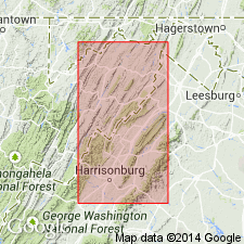
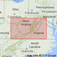
- Areal extent
- AAPG geologic province:
-
- Appalachian basin
Summary:
Romney shale restricted. In Frederick and Shenandoah Cos. Romney includes at base much black and gray fissile shale, which rests normally upon Onondaga shale. Upper part of Romney is dark-colored to black sandy fossiliferous shale. Millboro shale (named) includes the Marcellus and Naples shales of original Romney.
Source: GNU records (USGS DDS-6; Reston GNULEX).

- Usage in publication:
-
- Romney Shale*
- Modifications:
-
- Biostratigraphic dating
- AAPG geologic province:
-
- Appalachian basin
Summary:
Conodonts recovered from the Romney Shale in the Winchester 30 X 60 minute quadrangle are indicative of a Middle Devonian fauna. The term Romney Shale is used for an interval of poor exposure and complex structure correlative to the Needmore Shale, Marcellus Shale, Mahantango Formation, and Harrell Shale. This correlation also suggests an early Late Devonian age for the top of the Romney.
Source: GNU records (USGS DDS-6; Reston GNULEX).
For more information, please contact Nancy Stamm, Geologic Names Committee Secretary.
Asterisk (*) indicates published by U.S. Geological Survey authors.
"No current usage" (†) implies that a name has been abandoned or has fallen into disuse. Former usage and, if known, replacement name given in parentheses ( ).
Slash (/) indicates name conflicts with nomenclatural guidelines (CSN, 1933; ACSN, 1961, 1970; NACSN, 1983, 2005, 2021). May be explained within brackets ([ ]).