The National Geologic Map Database is migrating to a new infrastructure. We apologize for any service disruptions during this process.
|
|---|


- Usage in publication:
-
- Rollins sandstone member*
- Modifications:
-
- Named
- Dominant lithology:
-
- Sandstone
- AAPG geologic province:
-
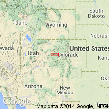
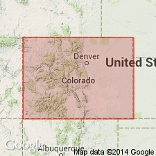
- Piceance basin
Summary:
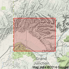
Named as one of three named units in the lower part of Mesaverde formation in the coal field for the Rollins Mine, north of Delta, Delta Co, CO in Piceance basin. No type locality designated. Is a massive white cliff-making sandstone that is persistent throughout the coal field. Contains marine invertebrates. Is 100+/-ft thick. Overlies Mancos shale; underlies Bowie shale member (new) of Mesaverde. Assigned a Montanan, Late Cretaceous age.
Source: GNU records (USGS DDS-6; Denver GNULEX).
- Usage in publication:
-
- Rollins sandstone member*
- Modifications:
-
- Revised
- AAPG geologic province:
-
- Piceance basin
Summary:
Reassigned from basal member of Mesaverde formation in Rollins mine area, Delta Co, CO, to a member 660 ft below top of Mount Garfield formation (new), middle formation of Mesaverde group in the Book Cliffs coal field, Garfield and Mesa Cos, CO in the Piceance basin. Overlies an unnamed part of Mount Garfield. Underlies Cameo coal zone of Mount Garfield. Is 71 ft thick in the type section (SW1/4 sec 8, T10S, R99W, Mesa Co) of the Mount Garfield where it consists of white, cliff-forming (gray-brown weathered), coarse-grained, sugary textured sandstone. Has 80 to 90 percent quartz, and 10 to 20 percent dark minerals. Prominently cross-bedded. Some thin bands and lenses of brown carbonaceous shale. Some carbonized wood and mud pellets. Fossil mollusks. Of littoral origin. Late Cretaceous age. Geologic map, stratigraphic chart.
Source: GNU records (USGS DDS-6; Denver GNULEX).
- Usage in publication:
-
- Rollins Sandstone Member
- Modifications:
-
- Areal extent
- Age modified
- Overview
- AAPG geologic province:
-
- Piceance basin
- Eagle basin
Summary:
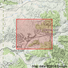
Is traced in subsurface across southern Piceance basin, western CO, east from Hunter Canyon, Mesa Co, where it is about 75 ft thick, to midway across basin where it passes into Mancos Shale by facies change and a new sandstone develops stratigraphically above the first; Rollins continues to rise stratigraphically eastward and at South Canyon Creek, Garfield Co, it is about 330 ft stratigraphically higher than at Hunter Canyon (fig. 2). Fig. 3 is correlation of measured sections along Grand Hogback from North Thompson Creek, Pitkin Co, Eagle basin, northward to White River, Rio Blanco Co, Piceance basin. Rollins is lithogenetic equivalent of both Cameo Member of Mesaverde and Trout Creek Sandstone Member of Iles Formation of Mesaverde Group. Name Rollins is used as far north as New Castle and name Trout Creek used north of New Castle along Grand Hogback. Rollins (or Trout Creek) is cliff-former with a thickness of 50-125 ft; overlain by coal and carbonaceous shale, and underlain by marine shale. In southernmost part of Grand Hogback, south of zero isopach of Cozzette Member (revised) of Mesaverde, Rollins is basal unit of Mesaverde; northward equivalent Trout Creek divides Williams Fork-Iles Formations of Mesaverde Group. BACULITES cf. B. CORRUGATUS collected 50 ft below base of Trout Creek at Piceance Creek section suggests that fossil is in EXITELOCERAS JENNEYI zone indicating a Campanian (Late Cretaceous) age.
Source: GNU records (USGS DDS-6; Denver GNULEX).
- Usage in publication:
-
- Rollins Sandstone [Member]
- Modifications:
-
- Revised
- Overview
- AAPG geologic province:
-
- Piceance basin
- Eagle basin
Summary:
Reassigned to Iles Formation (revised) of Mesaverde Group. Plate 2 is cross section of measured sections along Grand Hogback, western CO, from Coal Basin area, Pitkin Co, Eagle basin, north to White River, near Meeker, Rio Blanco Co, Piceance basin (Mancos Shale and Iles parts of sections are taken from Warner (1964)). Rollins is a prominent cliff-forming sandstone that caps Iles. Sandstone mapped (plate 1) as Rollins from Coal Basin area north to South Canyon; north of Rifle Gap, mapped as Trout Creek Sandstone [Member] of Iles. Between South Canyon and Rifle Gap, sandstone is complexly interfingered with underlying marine shales and because of difficulty with identification, sandstone interval is mapped as Trout Creek-Rollins. Somewhere south of Coal basin, underlying Cozzette Sandstone Member of Iles passes by facies change into Mancos Shale and Rollins becomes entire representation of Iles. Author believes that Rollins-Trout Creek are lithogenetically related to Cameo Sandstone of Book Cliffs-Grand Mesa area and that these units should be combined and given formation status, though no attempt to do so is made in this report. Underlies Williams Fork Formation (revised) of Mesaverde Group; tongue of Mancos separates Rollins from underlying Cozzette. Chart comparing nomenclature of previous workers. Late Cretaceous age.
Source: GNU records (USGS DDS-6; Denver GNULEX).
For more information, please contact Nancy Stamm, Geologic Names Committee Secretary.
Asterisk (*) indicates published by U.S. Geological Survey authors.
"No current usage" (†) implies that a name has been abandoned or has fallen into disuse. Former usage and, if known, replacement name given in parentheses ( ).
Slash (/) indicates name conflicts with nomenclatural guidelines (CSN, 1933; ACSN, 1961, 1970; NACSN, 1983, 2005, 2021). May be explained within brackets ([ ]).