

- Usage in publication:
-
- Rogers Spring formation*
- Modifications:
-
- Named
- Dominant lithology:
-
- Limestone
- AAPG geologic province:
-
- Great Basin province
Summary:
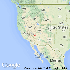
Named for exposures near Rogers Spring east of Callville Mountain, Clark Co, NV in the Great Basin province. No type locality designated. Geologic map, nomenclature table. Disconformably overlies Muddy Peaks limestone (new). Underlies Bluepoint limestone (new). Is part of a sequence at least 1,500 ft thick of carbonaceous, cherty limestone that can be divided into a lower 600+ ft thick unit named Rogers Spring formation and an upper 900+ ft thick unit named Bluepoint limestone. Sequence divisible only on basis of fossils (listed). The Rogers Spring considered to be Early Mississippian. Another special feature of Rogers Spring is the presence of dark quartzite in the upper half.
Source: GNU records (USGS DDS-6; Denver GNULEX).
- Usage in publication:
-
- Rogers Spring limestone*
- Modifications:
-
- Overview
- AAPG geologic province:
-
- Great Basin province
Summary:
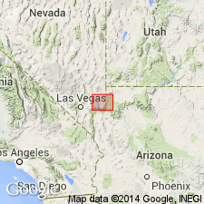
Mapped around the west, north, and east edges of White basin, Clark Co, NV in the Great Basin province with the overlying Bluepoint limestone. Geologic map. Unconformably overlies Muddy Peak limestone. Is about 600 ft thick. Consists of thin-bedded (at base) to generally massive, light- to dark-gray to black, granular limestone and dolomite with abundant gray chert as layers and lenses. All of the beds are carbonaceous. Fossiliferous (corals, brachiopods). Fauna is of Early Mississippian age.
Source: GNU records (USGS DDS-6; Denver GNULEX).
- Usage in publication:
-
- Rogers Spring limestone
- Modifications:
-
- Overview
- AAPG geologic province:
-
- Great Basin province
- Plateau sedimentary province
Summary:
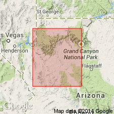
Is the western equivalent of the Redwall limestone. Decreases in thickness from 577 ft in the Virgin Mountains of AZ-NV (Plateau sedimentary and Great Basin provinces) to 281 ft at Jerome, AZ (Plateau sedimentary province). Overlies Devonian Muddy Peak limestone; underlies Pennsylvanian Callville limestone. Lower contact easily identified. The Devonian rocks weather brown-gray. The Rogers Spring is a dark-gray, fine- to medium-grained, coarse-grained to very fine grained, massive- to medium-bedded, light-gray weathering limestone. Sparsely fossiliferous. Mississippian age. Cross section. Measured section.
Source: GNU records (USGS DDS-6; Denver GNULEX).
For more information, please contact Nancy Stamm, Geologic Names Committee Secretary.
Asterisk (*) indicates published by U.S. Geological Survey authors.
"No current usage" (†) implies that a name has been abandoned or has fallen into disuse. Former usage and, if known, replacement name given in parentheses ( ).
Slash (/) indicates name conflicts with nomenclatural guidelines (CSN, 1933; ACSN, 1961, 1970; NACSN, 1983, 2005, 2021). May be explained within brackets ([ ]).