

- Usage in publication:
-
- Rogers Creek member*
- Modifications:
-
- Named
- Biostratigraphic dating
- Dominant lithology:
-
- Shale
- AAPG geologic province:
-
- Alaska Northern region
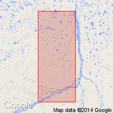
Summary:
Named as lowermost member (of 3) of Schrader Bluff formation of Colville group for exposures in upper part of Rogers Creek about 10 mi S 80 deg W of Umiat Mountain. Type section designated as Gubik test well no.1 from 295 to 890 ft and Gubik test well no.2 from 555 to 1140 ft, Colville River region, northern AK. Rocks formerly included in part of Tuluga member of Schrader Bluff formation. Very poorly exposed in Umiat areas but expressed as areas of subdued topography enclosed by cuestas formed by overlying Barrow Trail member (new) of Schrader Bluff formation. Consists of medium gray to medium light-gray shale. Is about 700 ft thick in Umiat area. Overlies and intertongues with Tuluvak tongue of Prince Creek formation of Colville group. Age is Late Cretaceous based on pelecypods.
Source: GNU records (USGS DDS-6; Menlo GNULEX).
- Usage in publication:
-
- Rogers Creek Member†
- Modifications:
-
- Abandoned
- AAPG geologic province:
-
- Alaska Northern region
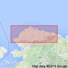
Summary:
Pg. 5 (fig. 4), 6-8 (table 1), 26. †Rogers Creek Member of Schrader Bluff Formation of †Colville Group. Abandoned. (†Colville also abandoned.) Rocks reassigned to unnamed lower part of Schrader Bluff Formation. [See Schrader Bluff.]
Source: Publication.
For more information, please contact Nancy Stamm, Geologic Names Committee Secretary.
Asterisk (*) indicates published by U.S. Geological Survey authors.
"No current usage" (†) implies that a name has been abandoned or has fallen into disuse. Former usage and, if known, replacement name given in parentheses ( ).
Slash (/) indicates name conflicts with nomenclatural guidelines (CSN, 1933; ACSN, 1961, 1970; NACSN, 1983, 2005, 2021). May be explained within brackets ([ ]).