- Usage in publication:
-
- Rodolfo Formation*
- Modifications:
-
- Named
- Dominant lithology:
-
- Sandstone
- Mudstone
- Siltstone
- Conglomerate
- Andesite
- AAPG geologic province:
-
- Basin-and-Range province
Summary:
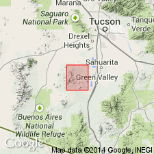
Named. Composite type locality is east, southeast, and west of Helmet Peak in secs 2, 11, and 12, T17S, R12E, Pima Co, AZ, Basin-and-Range province. Along Rodolfo Wash formation is at least 2,400 ft thick. Is nonresistant to erosion. Crops out discontinuously on pediment surfaces. Basal conglomerate 70+ ft thick consists of ill-sorted chert, quartzite, and limestone pebbles and cobbles in a light-gray to grayish-orange sandy matrix. Most are well rounded; some are subangular. Coarse grained sandstone occurs as lenses. Middle member 1,300+ ft thick consists of grayish-red siltstone, mudstone, and sandstone. Sandstone may be fine to coarse grained and includes grains of feldspar, quartz, sodic plagioclase, chert, siltstone, and sandstone. One lens of brown limestone and several lenses of pebble conglomerate. Upper member 1,100 ft thick consists of in sequence: a lower unit of andesite breccia, grayish-red sandstone, andesitic conglomerate and laharic breccia, and two andesite flows. Unconformably overlies rocks as young as Rainvalley Formation (Permian). Is younger than Ox Frame Volcanics. Unconformably overlain by rocks as old as Whitcomb Quartzite, new (Lower Cretaceous?). Is assigned a Triassic age on basis of stratigraphic position. Geologic map.
Source: GNU records (USGS DDS-6; Denver GNULEX).
For more information, please contact Nancy Stamm, Geologic Names Committee Secretary.
Asterisk (*) indicates published by U.S. Geological Survey authors.
"No current usage" (†) implies that a name has been abandoned or has fallen into disuse. Former usage and, if known, replacement name given in parentheses ( ).
Slash (/) indicates name conflicts with nomenclatural guidelines (CSN, 1933; ACSN, 1961, 1970; NACSN, 1983, 2005, 2021). May be explained within brackets ([ ]).

