

- Usage in publication:
-
- Rodman limestone*
- Modifications:
-
- Named
- Dominant lithology:
-
- Limestone
- AAPG geologic province:
-
- Appalachian basin
Summary:
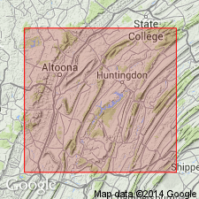
Rodman limestone (new name) of central PA described as dark crystalline limestone weathering with rough granulated surface. Thickness 30 ft. Upper formation of Black River group. Extends from Blair to Center Cos. Overlies Lowville limestone and underlies Trenton limestone. Age is Middle Ordovician.
Source: GNU records (USGS DDS-6; Reston GNULEX).
- Usage in publication:
-
- Rodman Member
- Modifications:
-
- Revised
- AAPG geologic province:
-
- Appalachian basin
Summary:
Revised the Rodman to the Rodman Member of the Nealmont Formation. Unit is upper member of formation. Consists of medium-dark-gray, light gray weathering, irregular and thin-bedded calcilutite with interbeds of medium-dark-gray, dark weathering, even and thicker-bedded coarse calcilutite and calcisiltite in lower 10 feet, and dark-tan-gray weathering, impure, medium to coarse bioclastic calcarenite with some scattered black chert in upper 20 feet. Thickness of member is 30 feet. Overlies Centre Hall Member of Nealmont Formation. The Rodman is of Middle Ordovician age.
Source: GNU records (USGS DDS-6; Reston GNULEX).
- Usage in publication:
-
- Rodman Formation
- Modifications:
-
- Revised
- AAPG geologic province:
-
- Appalachian basin
Summary:
Restored formation rank to the Rodman Formation because Nealmont Formation is not used. Unit is gray, fossiliferous limestone that overlies the Linden Hall Formation and underlies the Salona Formation. Thickness is 20 meters.
Source: GNU records (USGS DDS-6; Reston GNULEX).
- Usage in publication:
-
- Rodman Member
- Modifications:
-
- Overview
- AAPG geologic province:
-
- Appalachian basin
Summary:
Geologic map of PA shows the Rodman Member of the Nealmont Formation in central PA. Consists of medium-gray, fossiliferous limestone or calcarenite. Overlies the Center [sic] Hall Member of the Nealmont and underlies the Salona Formation.
Source: GNU records (USGS DDS-6; Reston GNULEX).
- Usage in publication:
-
- Rodman Member*
- Modifications:
-
- Overview
- AAPG geologic province:
-
- Appalachian basin
Summary:
The Rodman Member of the Nealmont Formation consists of medium-dark-gray, thin- and irregularly bedded, argillaceous, fossiliferous limestone that weathers light gray to light olive gray. Fossils include crinoid stems and plates and bryozoan debris. Thickness ranges from 15 to 30 feet. Overlies the Centre Hall Member of the Nealmont and underlies the Salona Formation.
Source: GNU records (USGS DDS-6; Reston GNULEX).
- Usage in publication:
-
- Rodman Formation
- Modifications:
-
- Overview
- AAPG geologic province:
-
- Appalachian basin
Summary:
Rodman and underlying Linden Hall Formation mapped together in study area because of poor exposures. Linden Hall is extended to include the Centre Hall Member as its uppermost unit. Both formations extend throughout the Valley and Ridge province in central PA and have been traced in the subsurface under the Appalachian plateau. The Rodman is a thick-bedded, nodular calcisiltite, dark-gray and medium-dark-gray. Contains crinoids, brachiopods, and other broken fossil debris. Thickness along PA Rte 453 west of Pemberton is 7+/-1 m. Contact with overlying Salona Formation is gradational. No basis given for Late Ordovician age assignment.
Source: GNU records (USGS DDS-6; Reston GNULEX).
For more information, please contact Nancy Stamm, Geologic Names Committee Secretary.
Asterisk (*) indicates published by U.S. Geological Survey authors.
"No current usage" (†) implies that a name has been abandoned or has fallen into disuse. Former usage and, if known, replacement name given in parentheses ( ).
Slash (/) indicates name conflicts with nomenclatural guidelines (CSN, 1933; ACSN, 1961, 1970; NACSN, 1983, 2005, 2021). May be explained within brackets ([ ]).