

- Usage in publication:
-
- Rocky Cedar limestone
- Modifications:
-
- Areal extent
- Dominant lithology:
-
- Limestone
- AAPG geologic province:
-
- East Texas basin
Summary:
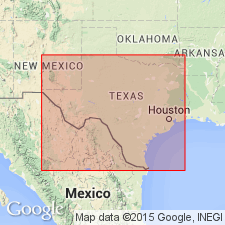
Pg. 19-20. Rocky Cedar limestone. At Rocky Cedar Creek, [Kaufman County, northeastern Texas], is deposit of shell limestone, composed almost entirely of shells of lower Eocene fossils. It is traceable up and down Rocky Cedar Creek for 7 miles, and underlies divide between Rocky Cedar and Muddy Cedar Creeks, a distance of 4 miles. Section of well on this divide shows: lower shell limestone 3 to 4 feet thick, coarse sand, 1.5 to 2 feet, shell limestone, 3 to 4 feet, gray and yellow clay (Basal Clays), 9 feet, gray and buff sand, 3 feet. About 1 mile below point where Texas Pacific Railroad crosses Rocky Cedar, an outcrop 15 feet thick of this limestone is present, and as it still forms bed of the creek, its thickness here must be still greater than that. Village of Elmo is situated on Muddy Cedar, and just beyond is black prairie region showing Cretaceous fossils. Consequently Rocky Cedar limestone is probably lowermost bed of Tertiary series in this part of State.
Source: US geologic names lexicon (USGS Bull. 1200, p. 3321-3322).
- Usage in publication:
-
- Rocky Cedar Creek limestone
- Modifications:
-
- Areal extent
- AAPG geologic province:
-
- East Texas basin
Harris, G.D., 1896, The Midway stage: Bulletins of American Paleontology, v. 1, no. 4, 157 p.
Summary:
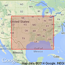
Pg. 41. Rocky Creek limestone. Divided the Midway of Kaufman County, northeastern Texas, into (descending) Wills Point clays and sands (upper Midway); Rocky Cedar Creek limestone (middle Midway); and clays west of Rocky Cedar Creek (lower Midway). [On p. 16 he listed the fossils from 5 miles west of Wills Point on Rocky Cedar Creek.]
Source: US geologic names lexicon (USGS Bull. 896, p. 1835).

- Usage in publication:
-
- Rocky Cedar Creek limestone lentil
- Modifications:
-
- Principal reference
- AAPG geologic province:
-
- East Texas basin
Summary:
Pg. 536, 539, 540, 541, 553. Rocky Cedar Creek limestone lentil of Pisgah member of Kincaid formation of Midway group. A local thin bed of gray fossiliferous limestone similar to Tehuacana limestone lentil of Pisgah member of Kincaid formation, but occurring slightly lower in Pisgah member. Thickness 12 to 16 feet. Age is Eocene.
Typically exposed in Ola quarry, 1 mi south of Ola, and along Rock Cedar Creek between Ola and Wills Point, Kaufman Co., northeastern TX.
Source: US geologic names lexicon (USGS Bull. 896, p. 1835).
For more information, please contact Nancy Stamm, Geologic Names Committee Secretary.
Asterisk (*) indicates published by U.S. Geological Survey authors.
"No current usage" (†) implies that a name has been abandoned or has fallen into disuse. Former usage and, if known, replacement name given in parentheses ( ).
Slash (/) indicates name conflicts with nomenclatural guidelines (CSN, 1933; ACSN, 1961, 1970; NACSN, 1983, 2005, 2021). May be explained within brackets ([ ]).