The National Geologic Map Database is migrating to a new infrastructure. We apologize for any service disruptions during this process.
|
|---|


- Usage in publication:
-
- Rockvale sandstone member*
- Modifications:
-
- Original reference
- Dominant lithology:
-
- Sandstone
- AAPG geologic province:
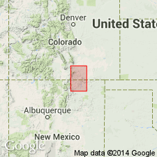
-
- Las Vegas-Raton basin
Summary:
Pg. 163-169. Rockvale sandstone member of Vermejo formation. Massive yellow to brown sandstone --the sandstone separating the two groups of coal-bearing beds in Vermejo formation. Contains marine invertebrate fossils [listed] of Fox Hills type, and great numbers of HALYMENITES MAJOR. Thickness 33 to 65 feet. Lies 300 to 382+/- feet above Rockvale coal (basal bed of Vermejo formation) and 30 feet above Royal Gorge coal beds. Age is Late Cretaceous.
Named from typical development near Rockvale, Fremont Co., eastern CO.
Source: US geologic names lexicon (USGS Bull. 896, p. 1833).
For more information, please contact Nancy Stamm, Geologic Names Committee Secretary.
Asterisk (*) indicates published by U.S. Geological Survey authors.
"No current usage" (†) implies that a name has been abandoned or has fallen into disuse. Former usage and, if known, replacement name given in parentheses ( ).
Slash (/) indicates name conflicts with nomenclatural guidelines (CSN, 1933; ACSN, 1961, 1970; NACSN, 1983, 2005, 2021). May be explained within brackets ([ ]).