The National Geologic Map Database is migrating to a new infrastructure. We apologize for any service disruptions during this process.
|
|---|


- Usage in publication:
-
- Rocktown channel sandstone member*
- Modifications:
-
- Named
- Dominant lithology:
-
- Clay
- Shale
- Sandstone
- AAPG geologic province:
-
- Central Kansas uplift
Summary:
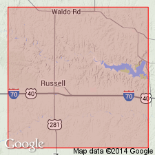
Named as a member of Dakota sandstone from excellent exposures at and near large group of "hoodoos" in NW1/4 sec 4, T13S, R11W, Russell Co, KS, Central Kansas uplift. No type locality designated. Occurs at any horizon from top to 125 ft below top of Dakota. Composed of a series of discontinuous, cross-bedded, buff-gray (fresh), brown, yellow, red, gray (weathered) sandstone that is mainly quartz, fine- to coarse-grained, angular to well rounded, and well sorted. A few thin lenses of blue-gray shale interbedded with sandstone. Some clay pebbles. Thickness varies laterally from 20-200 ft. Overlies unnamed part of Dakota; underlies Graneros shale. Is a stream deposit. Finer grained deposits deposited in backwater of floodplains and in bogs. Has fossil plants and worm tubes. Columnar section. Late Cretaceous age.
Source: GNU records (USGS DDS-6; Denver GNULEX).
For more information, please contact Nancy Stamm, Geologic Names Committee Secretary.
Asterisk (*) indicates published by U.S. Geological Survey authors.
"No current usage" (†) implies that a name has been abandoned or has fallen into disuse. Former usage and, if known, replacement name given in parentheses ( ).
Slash (/) indicates name conflicts with nomenclatural guidelines (CSN, 1933; ACSN, 1961, 1970; NACSN, 1983, 2005, 2021). May be explained within brackets ([ ]).