

- Usage in publication:
-
- Rockhouse Valley Sandstone Member*
- Modifications:
-
- Original reference
- Dominant lithology:
-
- Sandstone
- AAPG geologic province:
-
- Appalachian basin
Summary:
Rockhouse Valley Sandstone Member of Wise Formation. Medium- and fine-grained, feldspathic, massive sandstone with scattered dark grains. Thickness 35 to 125 feet. Lies below Wax coal bed (No. 9) and above Gin Creek coal bed (No. 8) in upper part of Wise Formation. [Age is Middle Pennsylvanian].
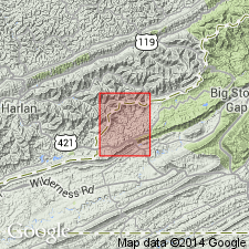
Named from feature [Rockhouse Creek] in northeast corner of Pennington Gap 7.5-min quadrangle, Harlan Co., eastern KY. Well exposed on abandoned road to stripping of Pardee coal bed up right (west) fork of Rockhouse Valley; [southwest of Holmes Mill, west fork of Rockhouse Creek, approx. 2,560 ft elev., Lat. 36 deg. 51 min. 33 sec. N., Long. 83 deg. 00 min. 58 sec. W., Pennington Gap 7.5-min quadrangle, Harlan Co., eastern KY].
Source: Publication; US geologic names lexicon (USGS Bull. 1520, p. 263).
For more information, please contact Nancy Stamm, Geologic Names Committee Secretary.
Asterisk (*) indicates published by U.S. Geological Survey authors.
"No current usage" (†) implies that a name has been abandoned or has fallen into disuse. Former usage and, if known, replacement name given in parentheses ( ).
Slash (/) indicates name conflicts with nomenclatural guidelines (CSN, 1933; ACSN, 1961, 1970; NACSN, 1983, 2005, 2021). May be explained within brackets ([ ]).