


- Usage in publication:
-
- Rockfish conglomerate
- Modifications:
-
- Named
- Dominant lithology:
-
- Conglomerate
- AAPG geologic province:
-
- Piedmont-Blue Ridge province
Summary:
Named for Rockfish River, Nelson Co., western VA. Named as basal conglomerate of Lynchburg gneiss [but not given member status]. Consists of coarse conglomerate. Lower 120 ft contains pebbles and boulders, both angular and rounded (or quartz, granite, and fine-grained siliceous gneiss), from 2 to 12 in. diameter embedded in sediment now composed of feldspar, blue quartz, and mica. Pebble size decreases upward in section. Thickness is about 800 ft. Upper part grades into mica gneiss correlated with Lynchburg gneiss. Lies next to Lovingston quartz monzonite and has appearance of augen gneiss or mylonite. Lovingston outcrops at base of conglomerate on north side of Rockfish River, while on south side of the river, an amphibolite dike crops out which occupies the place of a contact between Lovingston and Rockfish. An offshoot of the dike occurs near middle of Rockfish. Rockfish doesn't contain any pebbles of amphibolite, granodiorite, or Catoctin schist. Further work will probably show Rockfish extending south to Lynchburg and north into edge of Albemarle Co. [Age is Precambrian.]
Source: GNU records (USGS DDS-6; Reston GNULEX).
- Usage in publication:
-
- Rockfish conglomerate*
- Modifications:
-
- Overview
- AAPG geologic province:
-
- Piedmont-Blue Ridge province
Summary:
At many places in Catoctin Mountain-Blue Ridge and Mount Rogers anticlinoria, Rockfish conglomerate underlies Lynchburg gneiss. At type locality and elsewhere contains pebbles and boulders of granite and gneiss derived from Lovingston granite gneiss and granite of injection complex.
Source: GNU records (USGS DDS-6; Reston GNULEX).
- Usage in publication:
-
- Rockfish member
- Modifications:
-
- Revised
- AAPG geologic province:
-
- Piedmont-Blue Ridge province
Summary:
Referred to as Rockfish member of Lynchburg gneiss. Occurs in base of Lynchburg in lenticular bodies as much as 2 mi long and 1000 ft across at outcrop. Grades downward 10 to 100 ft into basement complex with decreasing clasts and bedding. Granite clasts were doubtlessly derived from Lovingston and Pedlar formations; biotite clasts probably from skialiths of basement complex gneiss.
Source: GNU records (USGS DDS-6; Reston GNULEX).
- Usage in publication:
-
- Rockfish formation
- Modifications:
-
- Revised
- Overview
- AAPG geologic province:
-
- Piedmont-Blue Ridge province
Summary:
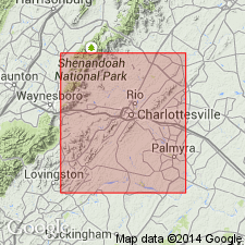
Rockfish occurs in a belt on southeast side of Lovingston gneiss from a point on Nelson Co. line, 1.3 mi northeast of Faber, to northwestern edge of Charlottesville. Rockfish unconformably overlies Lovingston gneiss; its basal 100 ft contains pebbles and boulders up to 12 inches in diameter of quartz monzonite from the Lovingston. There is no distinct boundary between Rockfish and overlying Lynchburg gneiss; coarse sediments of Rockfish grade quickly to fine-grained Lynchburg. Mechum River formation includes rocks of Swift Run formation and thinned down western edge of Charlottesville, Lynchburg, and Rockfish formations mapped as a unit. [Author is probably implying that Mechum River consists of rocks previously assigned to parts of other formations.]
Source: GNU records (USGS DDS-6; Reston GNULEX).

- Usage in publication:
-
- Rockfish Conglomerate
- Modifications:
-
- Geochronologic dating
- AAPG geologic province:
-
- Piedmont-Blue Ridge province
Summary:
Rb-Sr dating of six cobbles of granitic gneisses from Rockfish Conglomerate yielded ages of 1040 and 790 Ma. Authors caution that Rb-Sr ages from metasedimentary rocks are difficult to interpret because they may give age of deposition, or younger. [Interpretation of these ages is not discussed specifically.]
Source: GNU records (USGS DDS-6; Reston GNULEX).
- Usage in publication:
-
- Rockfish Conglomerate
- Modifications:
-
- Revised
- Overview
- Dominant lithology:
-
- Sandstone
- Conglomerate
- AAPG geologic province:
-
- Piedmont-Blue Ridge province
Summary:
Rockfish Conglomerate assigned to Lynchburg Group as its basal member in Rockfish River area of central VA. Nelson (1932) named Rockfish Conglomerate and later (Nelson, 1962) included in it coarser grained quartz sandstones of what is now mapped as Ball Mountain Formation. Rockfish used here as restricted to coarse-grained feldspathic sandstone, pebbly sandstone, and cobble conglomerate up to 500 m thick at base of Lynchburg Group. Lower contact with basement rocks marked by mylonitic zone. Upper contact with Thorofare Mountain Formation along Rockfish River is gradational and marked by uppermost occurrence of outsized clasts. North of Rockfish River, in Fan Mountains, Rockfish Conglomerate occurs below Ball Mountain Formation in a 500-m-wide belt. Representative outcrops are in 1) under bridge off VA Rte 617, 800 m west of Rockfish Station in Lovingston quad, and 2) in draw in Fan Mountains, 2.65 km 15 degrees SW of junction of Harris Branch and Hammer Branch, Covesville quad. Age is Late Proterozoic.
Source: GNU records (USGS DDS-6; Reston GNULEX).

- Usage in publication:
-
- Rockfish
- Modifications:
-
- Not used
- AAPG geologic province:
-
- Piedmont-Blue Ridge province
Summary:
Strata belonging to the Rockfish conglomerate formation and the Lynchburg gneiss formation (restricted) of Nelson (1962) are mapped here as part of the unnamed metagraywacke and unnamed fanglomerate of the Lynchburg Group.
Source: GNU records (USGS DDS-6; Reston GNULEX).
- Usage in publication:
-
- Rockfish Conglomerate*
- Modifications:
-
- Revised
- AAPG geologic province:
-
- Piedmont-Blue Ridge province
Summary:
Rockfish Conglomerate assigned to Fauquier Group (rank raised). Report includes geologic maps, correlation chart, and isotopic data.
Source: GNU records (USGS DDS-6; Reston GNULEX).
For more information, please contact Nancy Stamm, Geologic Names Committee Secretary.
Asterisk (*) indicates published by U.S. Geological Survey authors.
"No current usage" (†) implies that a name has been abandoned or has fallen into disuse. Former usage and, if known, replacement name given in parentheses ( ).
Slash (/) indicates name conflicts with nomenclatural guidelines (CSN, 1933; ACSN, 1961, 1970; NACSN, 1983, 2005, 2021). May be explained within brackets ([ ]).