

- Usage in publication:
-
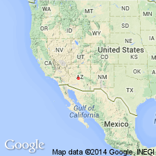
- Rock Springs Beds
- Modifications:
-
- Named
- Dominant lithology:
-
- Basalt
- Sandstone
- Conglomerate
- AAPG geologic province:
-
- Basin-and-Range province
Summary:
Named for some sedimentary and volcanic deposits in the valley between Bradshaw and New River Mountains, Yavapai Co, AZ, Basin-and-Range province, where it underlies a dissected plain and is well exposed on mesa. Named for town of Rock Springs. Composed principally of volcanic flows, tuffaceous sandstone, clastic sandstone, and conglomerate. Most common flows are olivine basalt, hornblende basalt or hornblende andesite. Tuffaceous sandstone is fine-grained pumice with minor amounts of rounded to subangular grains of quartz, feldspar, dark minerals; some mica; is poorly sorted, deeply weathered, poorly cemented. Clastic sandstone is fine grained, rounded to subrounded, well sorted, moderately to weakly cemented, usually with lime; the particles are quartz, feldspar, mica, and several dark minerals. Boulder conglomerate is poorly sorted and has indistinct bedding; has volcanic or Precambrian rock fragments. Two partial sections measured--1) 709 feet thick; 2) 424 feet thick. Thought to be a few hundred feet thick. Individual beds lens out or change character laterally. Extent of flows and beds limited areally. Changes vertically from predominantly tuffaceous lower part to predominantly volcanic flows upper part. Rests on irregular surface of Precambrian rocks. Has been extensively eroded; may have been 2,000 feet thick. No fossils. Similar to Pliocene Milk Creek Beds, but deposited in a different basin. Pliocene age assigned.
Source: GNU records (USGS DDS-6; Denver GNULEX).
For more information, please contact Nancy Stamm, Geologic Names Committee Secretary.
Asterisk (*) indicates published by U.S. Geological Survey authors.
"No current usage" (†) implies that a name has been abandoned or has fallen into disuse. Former usage and, if known, replacement name given in parentheses ( ).
Slash (/) indicates name conflicts with nomenclatural guidelines (CSN, 1933; ACSN, 1961, 1970; NACSN, 1983, 2005, 2021). May be explained within brackets ([ ]).