

- Usage in publication:
-
- Rock House Canyon Tuff
- Modifications:
-
- Named
- Dominant lithology:
-
- Tuff
- AAPG geologic province:
-
- Orogrande basin
Summary:
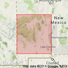
Named as a formation of Datil Group for Rock House Canyon, Socorro Co, NM in the Orogrande basin. Type section measured in SW1/4 sec 13, T1N, R8W, about 15 mi northeast of Datil and 3 mi north of North Lake at junction of Rock House Canyon with Long Canyon. Recognized in Datil, Gallinas, Crosby, and Magdalena Mountains, and Tres Montosas-Magdalena area. Formerly called tuff of Main Canyon and tuff of Nipple Mountain. Is a 225 ft thick, white, pink- to purple-gray, light-gray to tan, unwelded, slightly, poorly to moderately welded, crystal-poor ash flow tuff at type where it overlies Chavez Canyon Member (new) of Spears Formation and underlies Rincon Windmill Member of Spears. Ranges from 0-350 ft thick. Usually absent east of Magdalena area. May have abundant elliptical pumice, sparse sanidine and andesitic phenocrysts. Source unknown. Not dated. Assigned to the Oligocene.
Source: GNU records (USGS DDS-6; Denver GNULEX).
- Usage in publication:
-
- Rock House Canyon Tuff
- Modifications:
-
- Geochronologic dating
- AAPG geologic province:
-
- Basin-and-Range province
Summary:
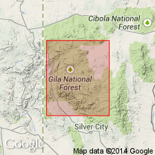
Has yielded ages of 28.3 +/-3.3 m.y. (zircon) [or Oligocene], Datil quad, Catron Co, NM, Basin-and-Range province.
Source: GNU records (USGS DDS-6; Denver GNULEX).
- Usage in publication:
-
- Rock House Canyon Tuff*
- Modifications:
-
- Overview
- Geochronologic dating
- Paleomagnetics
- AAPG geologic province:
-
- Basin-and-Range province
Summary:
Is formation in Datil Group. Is mapped in Horse Mountain West quadrangle, Catron Co, NM, in eastern part of Basin-and-Range province. Is light-gray, nearly white, phenocryst-poor, partially welded, vitroclastic ash-flow tuff, characterized by distinctive white pumice lapilli. Sparse tiny phenocrysts and microphenocrysts include sanidine, plagioclase, quartz, biotite, and rare hornblende. Contains as much as 1-2 percent small lithic fragments. Maximum thickness in this quad is about 30 m. Natural remanent magnetism determined as follows: mean inclination, -55.4; mean declination, 146.8; polarity, reversed. Isotopic dating: 40Ar/39Ar age is 34.81 Ma, Oligocene.
Source: GNU records (USGS DDS-6; Denver GNULEX).
For more information, please contact Nancy Stamm, Geologic Names Committee Secretary.
Asterisk (*) indicates published by U.S. Geological Survey authors.
"No current usage" (†) implies that a name has been abandoned or has fallen into disuse. Former usage and, if known, replacement name given in parentheses ( ).
Slash (/) indicates name conflicts with nomenclatural guidelines (CSN, 1933; ACSN, 1961, 1970; NACSN, 1983, 2005, 2021). May be explained within brackets ([ ]).