- Usage in publication:
-
- Roby Silt Member
- Modifications:
-
- Revised
- AAPG geologic province:
-
- Illinois basin
Summary:
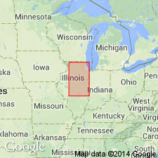
Revised, Roby Silt of Johnson (1964) reduced in rank and included as formal member of Glasford Formation (new) in south-central IL (Illinois basin). Reportedly named for Roby, Christian Co, IL, and the type section is the Roby Section (Johnson, 1964, p. 35), NW SE NE sec 14, T15N, R3W, Sangamon Co, IL. Consists of silt, clay, and sand, locally contains a fauna of fossil mollusks, and is locally as thick as 13 ft. Occurs below the Radnor Till Member (new) and above the Vandalia Till Member (revised) of the Glasford. Member is recognized only where it is bounded by these two tills. Its position below the Radnor suggests that the Roby is stratigraphically equivalent to the silt in the upper part of the Toulon Member (new) of central western IL. Is in the earliest part of the Jubileean Substage of the Illinoian Stage. Is a pro-glacial deposit of the advancing glacier that deposited the Radnor Till Member, and it was subsequently overridden by that glacier.
Source: GNU records (USGS DDS-6; Denver GNULEX).
For more information, please contact Nancy Stamm, Geologic Names Committee Secretary.
Asterisk (*) indicates published by U.S. Geological Survey authors.
"No current usage" (†) implies that a name has been abandoned or has fallen into disuse. Former usage and, if known, replacement name given in parentheses ( ).
Slash (/) indicates name conflicts with nomenclatural guidelines (CSN, 1933; ACSN, 1961, 1970; NACSN, 1983, 2005, 2021). May be explained within brackets ([ ]).

