The National Geologic Map Database is migrating to a new infrastructure. We apologize for any service disruptions during this process.
|
|---|


- Usage in publication:
-
- Robles formation*
- Modifications:
-
- Revised
- AAPG geologic province:
-
- Caribbean region
Summary:
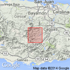
In the Cayey quadrangle the Robles includes an unnamed lapilli tuff member at the base, and the here named Rio Maton limestone, Lapa lava, Cayey siltstone, Las Tetas lava, and Collao members. Age is Late Cretaceous or older.
Source: GNU records (USGS DDS-6; Reston GNULEX).
- Usage in publication:
-
- Robles formation*
- Modifications:
-
- Named
- Dominant lithology:
-
- Limestone
- Lava
- Sandstone
- Siltstone
- AAPG geologic province:
-
- Caribbean region
Summary:
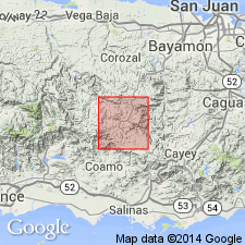
The Robles formation is here named in the Comerio quadrangle where it includes the Rio Maton limestone, Lapa lava, and Las Tetas lava members. Consists of well-bedded sandstone and siltstone with thin lava flows and breccias. Conformably overlies informal formation K. Maximum thickness is 1,200 m. Age is early to middle Late Cretaceous.
Source: GNU records (USGS DDS-6; Reston GNULEX).
- Usage in publication:
-
- Robles formation*
- Modifications:
-
- Revised
- AAPG geologic province:
-
- Caribbean region
Summary:
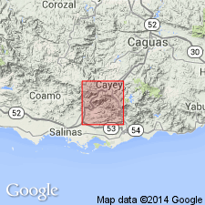
The Canabon lava member of the Robles formation, here named in the Barranquitas quadrangle, consists of grayish-black augite phenocryst lava. Overlies the Las Tetas lava member near the top of the Robles. Age is Late Cretaceous.
Source: GNU records (USGS DDS-6; Reston GNULEX).
- Usage in publication:
-
- Robles Formation
- Modifications:
-
- Revised
- AAPG geologic province:
-
- Caribbean region
Summary:
Robles Formation is here subdivided into 3 members in the Barranquitas quadrangle: the basal Barranquitas Tuff Member, the Lapa Andesite Member, and the Helechal Tuff Member at the top.
Source: GNU records (USGS DDS-6; Reston GNULEX).
- Usage in publication:
-
- Robles Formation*
- Modifications:
-
- Revised
- AAPG geologic province:
-
- Caribbean region
Summary:
Rocks of the Cuyon Formation, here named in the Cayey quadrangle, were previously included in the Robles Formation of Berryhill and Glover (1960). Consists of 75 m of heterogeneous rocks divided into three subequal parts: 1. basal third is reddish- to purplish gray poorly sorted, obscurely stratified volcaniclastic sandstone; 2. middle third is drab thin- to thick-bedded reworked tuff with lenses of volcaniclastic conglomerate; 3. upper third is bluish-gray hard, fossiliferous, thin- to thick-bedded limestone interleaved with volcanic sandstone. Unconformably overlies Robles Formation; upper contact eroded or cut out by faulting.
Source: GNU records (USGS DDS-6; Reston GNULEX).
- Usage in publication:
-
- Robles Formation*
- Modifications:
-
- Age modified
- Biostratigraphic dating
- AAPG geologic province:
-
- Caribbean region
Summary:
Age of Robles Formation is Albian, Cenomanian, and possibly Santonian based on Foraminifera.
Source: GNU records (USGS DDS-6; Reston GNULEX).
- Usage in publication:
-
- Robles Formation*
- Modifications:
-
- Revised
- AAPG geologic province:
-
- Caribbean region
Summary:
In the Coamo area of south-central Puerto Rico the Robles includes the Rio Maton Limestone, Lapa Lava, and Las Tetas Lava Members. Disconformably overlies pre-Robles rocks (Fajardo Formation); disconformably underlies the Cariblanco Formation. Age is Albian to Santonian.
Source: GNU records (USGS DDS-6; Reston GNULEX).
- Usage in publication:
-
- Robles Formation*
- Modifications:
-
- Revised
- AAPG geologic province:
-
- Caribbean region
Summary:
In the Adjuntas quadrangle the Maricao Formation was mapped as the Robles by Mattson (1968), but is unlike the Robles of the type locality. Along the border of the Adjuntas and Penuelas quadrangles, the Robles (Maricao) is identical to the Anon (former Santas Pascuas Member). The Robles Formation mapped in the Bayaney and Adjuntas quadrangles is actually the Maricao Formation.
Source: GNU records (USGS DDS-6; Reston GNULEX).
- Usage in publication:
-
- Robles Formation*
- Modifications:
-
- Overview
- AAPG geologic province:
-
- Caribbean region
Summary:
On figure 3, the Robles Formation is of Late Cretaceous, Coniacian age based on rudist bivalves. It is overlain by the Cariblanco Formation.
Source: GNU records (USGS DDS-6; Reston GNULEX).

- Usage in publication:
-
- Robles Formation*
- Modifications:
-
- Overview
- AAPG geologic province:
-
- Caribbean region
Summary:
The Robles Formation occurs in central Puerto Rico and consists of chiefly volcaniclastic sandstone and siltstone, subordinate lava and minor limestone, conglomerate and breccia. In the Cayey quad., a calcarenite occurs at the base. Two pillowed basaltic andesite flows are enclosed in the sandstone-siltstone sequence. In the Barranquitas quad., the Robles is equivalent to the Magueyes Formation. Estimated thickness of Robles is 1200 meters. The Robles is of Cretaceous age.
Source: GNU records (USGS DDS-6; Reston GNULEX).
For more information, please contact Nancy Stamm, Geologic Names Committee Secretary.
Asterisk (*) indicates published by U.S. Geological Survey authors.
"No current usage" (†) implies that a name has been abandoned or has fallen into disuse. Former usage and, if known, replacement name given in parentheses ( ).
Slash (/) indicates name conflicts with nomenclatural guidelines (CSN, 1933; ACSN, 1961, 1970; NACSN, 1983, 2005, 2021). May be explained within brackets ([ ]).