The National Geologic Map Database is migrating to a new infrastructure. We apologize for any service disruptions during this process.
|
|---|


- Usage in publication:
-
- Robinson limestone*
- Modifications:
-
- Named
- Dominant lithology:
-
- Limestone
- AAPG geologic province:
-
- Eagle basin
Summary:
Pg. 215-230; 1886 (USGS Monograph 12, p. 69, 198, 279, 598, 646); and 1898 (USGS Tenmile Special Folio, no. 48). Robinson limestone member of Maroon formation. Light bluish gray or drab compact limestone, resembling lithographic stone; conchoidal fracture; somewhat dolomitic at base. Basal member of Maroon formaton. Age is Pennsylvanian(?).
[Named for fact it forms the ore-bearing horizon of Robinson mine, in Tenmile district, Summit Co., CO.]
Source: US geologic names lexicon (USGS Bull. 896, p. 1822).
- Usage in publication:
-
- Robinson limestone member*
- Modifications:
-
- Revised
- AAPG geologic province:
-
- Eagle basin
Summary:
Pg. 1376 (fig. 1), 1378 (fig. 2), 1380-1383, 1384. Robinson limestone member of Battle Mountain formation. Reallocated to member status in Battle Mountain formation (new). Consists of dark gray to black dolomite, nodular with black shale partings, calcareous at base. Thickness 15 feet (bed interval 153) in type section of Battle Mountain formation. Is separated from underlying Belden shale member (new) and overlying Jacque Mountain member by unnamed dark gray dolomite. [Age is Pennsylvanian.]
Source: US geologic names lexicon (USGS Bull. 1200, p. 3298); GNU records (USGS DDS-6; Denver GNULEX).
- Usage in publication:
-
- Robinson limestone*
- Modifications:
-
- Overview
- AAPG geologic province:
-
- Eagle basin
Summary:
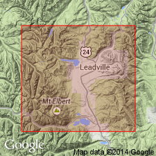
Occurs at base of middle unranked unit of unnamed sequence of Pennsylvanian age. Named according to authors for the Robinson mine in the Tenmile district, Summit Co, CO in the Eagle basin. Is well exposed on East Sheep Mountain and fairly well exposed on southwest side of Elk Ridge east of Kokomo Pass. Composed of three beds at most places. Lowest bed is black limestone, which is separated from the middle bed also known as the Robinson bed, a gray limestone, by sandstone about 18 ft thick. The upper bed is gray limestone 20 ft thick. The upper and middle beds are separated by 200 ft of sandstone. Des Moines age fossils (brachiopods). Overlies lower unit--an interbedded white to gray sandstone, grit, arkose, and conglomerate, black carbonaceous shale, dolomitic and cherty limestone sequence--of unnamed Pennsylvanian sequence. Underlies unnamed cream to gray micaceous sandstone and black carbonaceous shale of the middle unit of the unnamed Pennsylvanian sequence. Geologic map. Stratigraphic section.
Source: GNU records (USGS DDS-6; Denver GNULEX).
- Usage in publication:
-
- Robinson limestone member*
- Modifications:
-
- Revised
- AAPG geologic province:
-
- Eagle basin
Summary:
Pg. 152 (table 1), 201-202, 211-215. Robinson limestone member of Minturn formation.
Given formal member status in the Minturn Formation; formerly called Robinson limestone in Kokomo area; basal bed of Maroon formation by Emmons (1898); basal bed of the "middle unit" of the Pennsylvanian and Permian?, and as a member of Battle Mountain formation by Brill (1942). Brill's type section of Robinson along Turkey Creek in Minturn quad is Hornsilver dolomite member of this report. Measured sections on Ptarmigan Hill and Resolution Mountain described. Composed of 3 to 5 gray limestone beds 3 to 21 ft thick, and separated by 40 to 85 ft of clastic rocks (interbedded red, gray, and green conglomerate, grit and shale). The limestone beds are thin-bedded to massive and locally grade into calcareous black shale. Is 300 to 400 ft thick. Lies 4,200 ft above base of Minturn. The limestones are fossiliferous (fusulinids and larger? fossils). Underlies unnamed clastic unit. Assigned to the Pennsylvanian.
Source: GNU records (USGS DDS-6; Denver GNULEX).
- Usage in publication:
-
- Robinson Limestone Member*
- Modifications:
-
- Overview
- Age modified
- AAPG geologic province:
-
- Eagle basin
Summary:
The Robinson Limestone Member of the Minturn Formation at the type section of the Minturn consists of six carbonate beds, each 5 to 65 ft thick separated by gray siltstone and sandstone. The Minturn type was measured and is designated in this report as in sec 22, T5S, R80W to SE1/4 sec 13, T6S, R81W, Eagle Co, CO, Eagle basin. Was named originally for three limestones and intervening clastic rocks at the Robinson mine in the Kokomo district, Eagle Co. The carbonates are mostly limestone that is gray, fine, medium to coarse grained, fossiliferous, thin to medium bedded. The subordinate dolomite is gray, medium grained, and ranges from thin to thick bedded. Member is 746 ft thick at the Minturn type. Overlies clastic unit E of Minturn. Underlies clastic unit F of Minturn. Abundant fossils, brachiopods, pelecypods, fusulinids, corals, bryozoans, echinoderms, gastropods,, cephalopods. Fossils listed. Age modified from Middle Pennsylvanian to Des Moines. Geologic map.
Source: GNU records (USGS DDS-6; Denver GNULEX).
- Usage in publication:
-
- Robinson Limestone Member*
- Modifications:
-
- Revised
- AAPG geologic province:
-
- Eagle basin
Summary:
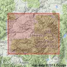
Can be traced west in six measured sections from type Minturn Formation to Avon, Eagle Co, CO and across Wolcott syncline where name Eagle Valley Evaporite is used. Is assigned to Eagle Valley near Avon as Robinson Limestone Member. On west side of Wolcott syncline, the lower and middle limestone beds of the Robinson can be recognized. However, identification of the upper limestone bed is uncertain on the west side. Overlies and underlies unnamed clastic sequences of Eagle Valley. Is of Middle Pennsylvanian age.
Source: GNU records (USGS DDS-6; Denver GNULEX).
For more information, please contact Nancy Stamm, Geologic Names Committee Secretary.
Asterisk (*) indicates published by U.S. Geological Survey authors.
"No current usage" (†) implies that a name has been abandoned or has fallen into disuse. Former usage and, if known, replacement name given in parentheses ( ).
Slash (/) indicates name conflicts with nomenclatural guidelines (CSN, 1933; ACSN, 1961, 1970; NACSN, 1983, 2005, 2021). May be explained within brackets ([ ]).