The National Geologic Map Database is migrating to a new infrastructure. We apologize for any service disruptions during this process.
|
|---|


- Usage in publication:
-
- Robinson Canyon Member
- Modifications:
-
- Named
- Dominant lithology:
-
- Sandstone
- Conglomerate
- AAPG geologic province:
-
- California Coast Ranges province
Summary:
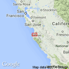
Named for excellent exposures at type section along Robinson Canyon road to northeast of Chamisal Ridge, Point Sur 15' quad, Monterey Co, CA. Is lower member (of 2) of Chamisal Formation (new). Bulk of member at type section consists of light red to moderate orange pink coarse arkosic sandstone with intertonguing conglomerate. Is 450 ft thick. Is continuously exposed over 0.5 sq mi and is believed to underlie 4 sq mi; rests on granitic basement rocks [Sur Series]. Is conformably and gradationally overlain by Los Tularcitos Member (new) (Chamisal Formation). Contains no fossils. Assigned middle Miocene age based on stratigraphic relations with Los Tularcitos Member.
Source: GNU records (USGS DDS-6; Menlo GNULEX).
For more information, please contact Nancy Stamm, Geologic Names Committee Secretary.
Asterisk (*) indicates published by U.S. Geological Survey authors.
"No current usage" (†) implies that a name has been abandoned or has fallen into disuse. Former usage and, if known, replacement name given in parentheses ( ).
Slash (/) indicates name conflicts with nomenclatural guidelines (CSN, 1933; ACSN, 1961, 1970; NACSN, 1983, 2005, 2021). May be explained within brackets ([ ]).