The National Geologic Map Database is migrating to a new infrastructure. We apologize for any service disruptions during this process.
|
|---|


- Usage in publication:
-
- Robeson conglomerate
- Modifications:
-
- Named
- Dominant lithology:
-
- Conglomerate
- AAPG geologic province:
-
- Gettysburg basin
- Piedmont-Blue Ridge province
Summary:
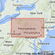
A thick succession of coarse red brown conglomerate interbedded with arkosic sandstone that forms an alluvial fan S of Reading and W of the Schuylkill River in PA is here named the Robeson Conglomerate. It extends W across northern New Holland and Lancaster 15' quads, and occupies Furnace Ridge, a prominent ridge through the center of the Triassic belt. It is the stratigraphic equivalent of the Lockatong and Brunswick Formations. The source of the conglomerate was a Paleozoic overthrust block to the N of the downfaulted Triassic basin.
Source: GNU records (USGS DDS-6; Reston GNULEX).
- Usage in publication:
-
- Robeson†
- Modifications:
-
- Abandoned
- AAPG geologic province:
-
- Piedmont-Blue Ridge province
Summary:
The Hammer Creek Formation, defined between the Dauphin-Lebanon County line on the west and the Schuylkill River on the east, includes rocks previously defined as the Robeson Conglomerate and the Elizabeth Furnace and Furnace Ridge Conglomerate Members of the Gettysburg Formation. The Robeson Conglomerate is not recognized in the Hammer Creek Formation.
Source: GNU records (USGS DDS-6; Reston GNULEX).
For more information, please contact Nancy Stamm, Geologic Names Committee Secretary.
Asterisk (*) indicates published by U.S. Geological Survey authors.
"No current usage" (†) implies that a name has been abandoned or has fallen into disuse. Former usage and, if known, replacement name given in parentheses ( ).
Slash (/) indicates name conflicts with nomenclatural guidelines (CSN, 1933; ACSN, 1961, 1970; NACSN, 1983, 2005, 2021). May be explained within brackets ([ ]).