

- Usage in publication:
-
- Robertson River Formation
- Modifications:
-
- Named
- Dominant lithology:
-
- Granite
- Syenite
- AAPG geologic province:
-
- Piedmont-Blue Ridge province
Summary:
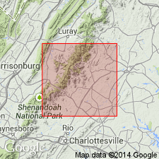
Name Robertson River Formation suggested for northeastward-trending exposures of hornblende granite and hornblende syenite that crop out roughly parallel to U.S. Hwy 29 throughout Greene and Madison Cos. Formation is about 1.5 mi wide in Greene Co. and crops out on both sides of U.S. Hwy 29. Outcrop widens to about 3 mi in vicinity of Shelby, Madison Co., and to northeast of Madison is about 4 mi wide. Robertson River is in contact with Lovingston Formation along its northwest border and with Lynchburg Formation on southeast. In Brightwood area, Madison Co., a zone of Lovingston lies to southeast of Robertson River formation. Southeast of Robertson River--Lynchburg contact, outliers of Robertson River are within the Lynchburg. Contact with Lovingston is gradational. Contact with Lynchburg generally sharp and marked by silicified zone. Age is Precambrian.
Source: GNU records (USGS DDS-6; Reston GNULEX).
- Usage in publication:
-
- Robertson River Igneous Suite
- Modifications:
-
- Revised
- AAPG geologic province:
-
- Piedmont-Blue Ridge province
Summary:
Tollo and Arav (in press) propose that Robertson River Formation of Allen (1963) be revised as Robertson River Igneous Suite to emphasize the lithologic diversity that characterizes this belt. Rocks range in composition from alkali syenite to alkali feldspar granite to granite. This suite is the largest group of intrusives within the Blue Ridge province of VA. Extends from near Upperville, 70 mi southwest to northern suburbs of Charlottesville. Includes at least nine mappable lithologic units: Cobbler Mountain Alkali Feldspar Quartz Syenite (Arav, 1989), Amissville Alkali Feldspar Granite (Arav, 1989), Laurel Mills Granite (Tollo and Arav, in press), Battle Mountain Complex (Wallace and Tollo, 1986), Arrington Mountain Alkali Feldspar Granite (Lowe, 1990), Hitt Mountain Alkali Feldspar Syenite (Lowe, 1990), White Oak Alkali Feldspar Granite (Lowe, 1990), Rivanna Alkali Feldspar Granite, and Deep Run Granite.
Source: GNU records (USGS DDS-6; Reston GNULEX).

- Usage in publication:
-
- Robertson River Igneous Suite
- Modifications:
-
- Overview
- AAPG geologic province:
-
- Piedmont-Blue Ridge province
Summary:
Late Proterozoic Robertson River Igneous Suite used on new State geologic map following nomenclature of Tollo and Lowe (199_, USGS MF-2229). Suite divided into nine, rather than eight, map units: Battle Mountain Alkali Feldspar Granite felsite; Battle Mountain Alkali Feldspar Granite granitoid; Amissville Alkali Feldspar Granite; Hitt Mountain Alkali Feldspar Syenite; Cobbler Mountain Alkali Feldspar Quartz Syenite; White Oak Alkali Feldspar Granite; Laurel Mills Granite; Arrington Mountain Alkali Feldspar Granite; and Rivanna Granite.
Source: GNU records (USGS DDS-6; Reston GNULEX).
- Usage in publication:
-
- Robertson River Formation*
- Modifications:
-
- Geochronologic dating
- AAPG geologic province:
-
- Piedmont-Blue Ridge province
Summary:
Robertson River Formation has been dated isotopically as follows: U-Pb zircon age of 732+/-5 Ma (Lukert and Banks, 1984; Tollo and Lowe, 1990); and Pb-Pb zircon age of 655 Ma (T.W. Stern, IN Rankin, 1975; recalculated by Rankin and others, this report).
Source: GNU records (USGS DDS-6; Reston GNULEX).
- Usage in publication:
-
- Robertson River Igneous Suite*
- Modifications:
-
- Revised
- Areal extent
- AAPG geologic province:
-
- Piedmont-Blue Ridge province
Summary:
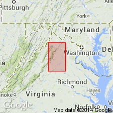
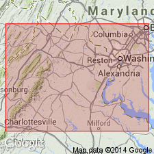
Recent detailed mapping and petrologic analysis indicate rocks previously assigned to Robertson River Formation include a series of granitoids, syenitoids, and felsites emplaced sequentially during 30 m.y. episode of magmatism. Therefore, name is revised to Robertson River Igneous Suite. At least 8 units of the suite are distinguishable by mineral composition, texture, bulk chemical composition, and U-Pb-determined isotopic age, and can be mapped at 1:24,000 scale. Collectively, the rocks form a dike-like mass of intrusions extending nearly 100 km from vicinity of Charlottesville, VA, to north-northwest of Ashby Gap, VA. Includes (oldest to youngest) Rivanna Granite, Laurel Mills Granite, Arrington Mountain Alkali Feldspar Granite, White Oak Alkali Feldspar Granite, Cobbler Mountain Alkali Feldspar Quartz Syenite, Hitt Mountain Alkali Feldspar Syenite, Amissville Alkali Feldspar Granite, and Battle Mountain Alkali Feldspar Granite (which includes granite and felsite components). [Report revises some of the names shown in Tollo and others (1991) according to lithologic terms in LeMaitre and others (1989; A classification of igneous rocks and glossary of terms: Oxford, Blackwell Scientific Publications).] Report includes geologic map.
Source: GNU records (USGS DDS-6; Reston GNULEX).
- Usage in publication:
-
- Robertson River Igneous Suite*
- Modifications:
-
- Geochronologic dating
- AAPG geologic province:
-
- Piedmont-Blue Ridge province
Summary:
New U-Pb isotopic data for zircons from Robertson River Igneous Suite indicate ages ranging from 735+/-4 Ma to 702 Ma. U-Pb zircon ages are as follows (from table 4): Rivanna Granite, 735+/-4 Ma; Laurel Mills Granite, 729+/-1 Ma; Arrington Mountain Alkali Feldspar Granite, 730+/-4 Ma; White Oak Alkali Feldspar Granite, 724+/-3 Ma; Cobbler Mountain Alkali Feldspar Quartz Syenite, 722+/-3 Ma; Hitt Mountain Alkali Feldspar Syenite, 706+/-2 Ma; Amissville Alkali Feldspar Granite, about 700? Ma; granite of Battle Mountain Alkali Feldspar Granite, 705+/-2 Ma; felsite of Battle Mountain Alkali Feldspar Granite, about 702 Ma.
Source: GNU records (USGS DDS-6; Reston GNULEX).
For more information, please contact Nancy Stamm, Geologic Names Committee Secretary.
Asterisk (*) indicates published by U.S. Geological Survey authors.
"No current usage" (†) implies that a name has been abandoned or has fallen into disuse. Former usage and, if known, replacement name given in parentheses ( ).
Slash (/) indicates name conflicts with nomenclatural guidelines (CSN, 1933; ACSN, 1961, 1970; NACSN, 1983, 2005, 2021). May be explained within brackets ([ ]).