The National Geologic Map Database is migrating to a new infrastructure. We apologize for any service disruptions during this process.
|
|---|


- Usage in publication:
-
- Robertson formation
- Modifications:
-
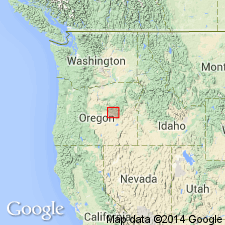
- Areal extent
- AAPG geologic province:
-
- Snake River basin
Summary:
Lower Jurassic sequence in Izee area, Grant County, central Oregon, includes Robertson, [Suplee], Nicely, and Hyde formations. Uppermost unit in Triassic sequence is Graylock formation (new).
Source: US geologic names lexicon (USGS Bull. 1200, p. 3297).
For more information, please contact Nancy Stamm, Geologic Names Committee Secretary.
Asterisk (*) indicates published by U.S. Geological Survey authors.
"No current usage" (†) implies that a name has been abandoned or has fallen into disuse. Former usage and, if known, replacement name given in parentheses ( ).
Slash (/) indicates name conflicts with nomenclatural guidelines (CSN, 1933; ACSN, 1961, 1970; NACSN, 1983, 2005, 2021). May be explained within brackets ([ ]).