

- Usage in publication:
-
- Robbins Chapel Sandstone Member*
- Modifications:
-
- Original reference
- Dominant lithology:
-
- Sandstone
- AAPG geologic province:
-
- Appalachian basin
Summary:
Pg. 25, 27, 57-58. Robbins Chapel Sandstone Member of Wise Formation. Cliff-forming, brown, gray, or orange, medium- and fine-grained, massive, moderately quartzose sandstone. Some units are markedly cross-bedded, and some are micaceous. Thickness 80+ feet at type section. Is about 120 to 150 feet above base of Wise. Lies 0 to 16 feet above No. 2 and 10 to 14 feet below No. 3 coal beds. [Age is Middle Pennsylvanian].
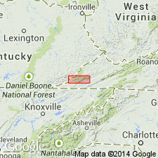
Type section: at Robbins Chapel, beginning on secondary State Road 606 at top of long hill, 1,900 ft S. 27 deg. W. of brick church at Robbins Chapel and 20 ft north of where two powerlines cross directly above road, Keokee 7.5-min quadrangle, Lee Co., southwestern VA. Named from community of Robbins Chapel, in northwestern part of Keokee 7.5-min quadrangle, Lee Co., southwestern VA.
Source: Publication; GNU records (USGS DDS-6; Reston GNULEX); US geologic names lexicon (USGS Bull. 1520, p. 261).
For more information, please contact Nancy Stamm, Geologic Names Committee Secretary.
Asterisk (*) indicates published by U.S. Geological Survey authors.
"No current usage" (†) implies that a name has been abandoned or has fallen into disuse. Former usage and, if known, replacement name given in parentheses ( ).
Slash (/) indicates name conflicts with nomenclatural guidelines (CSN, 1933; ACSN, 1961, 1970; NACSN, 1983, 2005, 2021). May be explained within brackets ([ ]).