The National Geologic Map Database is migrating to a new infrastructure. We apologize for any service disruptions during this process.
|
|---|


- Usage in publication:
-
- Road Runner Rhyolite*
- Modifications:
-
- Named
- Dominant lithology:
-
- Rhyolite
- AAPG geologic province:
-
- Basin-and-Range province
Summary:
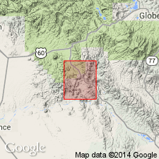
Named for exposures at Road Runner Mesa, its type locality, in S1/2 sec 27 and N1/2 sec 34, T2S, R12E, Pinal Co, AZ in the Basin-and-Range province. Occurs from the mesa north to Wood Canyon in sec 21, T2S, R12E and in three separate exposures west of Wood Canyon in the northwest part of the quad. Occurs as flows and as a semicircular plug. Is younger than the newly named Sleeping Buffalo Rhyolite. The pinkish-gray flow-banded rhyolite has a porphyritic and glomeroporphyritic texture with a vitrophyric or devitrified groundmass for the flows and a microcrystalline microlitic groundmass for the plug. Vesicles and amygdules occur in both the flow and the plug. Phenocrysts which make up 25-35 percent of the rock consist of plagioclase (10-20 percent), quartz (5-15 percent), biotite (2-5 percent), and magnetite (less than 1 percent). Plagioclase is oligoclase-andesine; individual euhedral to subhedral phenocrysts are as much as 4 mm long; glomeroporphyritic clusters of anhedral crystals are as much as 5 mm in diameter. Quartz phenocrysts are as much as 4 mm in diameter. Biotite phenocrysts are as much as 2 mm in diameter. Magnetite is in all samples. Hornblende occurs in about a third of the samples. Zircon and apatite are accessories. K-Ar whole rock age of 18.9 +/-1.4 m.y. obtained on the plug. Of Miocene age.
Source: GNU records (USGS DDS-6; Denver GNULEX).
For more information, please contact Nancy Stamm, Geologic Names Committee Secretary.
Asterisk (*) indicates published by U.S. Geological Survey authors.
"No current usage" (†) implies that a name has been abandoned or has fallen into disuse. Former usage and, if known, replacement name given in parentheses ( ).
Slash (/) indicates name conflicts with nomenclatural guidelines (CSN, 1933; ACSN, 1961, 1970; NACSN, 1983, 2005, 2021). May be explained within brackets ([ ]).