

- Usage in publication:
-
- Rio Salado Tongue*
- Modifications:
-
- Named
- Dominant lithology:
-
- Shale
- Limestone
- AAPG geologic province:
-
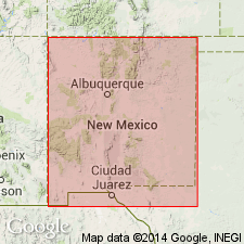
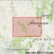
- Orogrande basin
Summary:
Named as a tongue of Mancos Shale for exposures along Rio Salado, Socorro Co, NM in Orogrande basin. Type section measured in NE1/4 sec 33, T3N, R6W. Is present wherever underlying Twowells Tongue of Dakota Sandstone and overlying Atarque Sandstone Member of Tres Hermanos Formation are present. Member cannot be differentiated from Riley to Carthage and Truth or Consequences, although limestones within Bridge Creek can. Is composed of 1) lower calcareous fossiliferous shale, 35 ft thick, 2) Bridge Creek Limestone Beds (reduced in stratigraphic rank and replaces use of Greenhorn in area) gray fossiliferous shale, calcarenite, and limestone 47 ft thick, and 3) upper light olive gray, calcareous to noncalcareous shale, at type. Ranges from 200 to 300 ft thick. Is of Late Cretaceous age. Top becomes younger eastward. Has ammonites from METOICOCERAS MOSBYENSE (late Cenomanian) to COLLINGNONICERAS WOOLLGARI (early middle Turonian) Zones.
Source: GNU records (USGS DDS-6; Denver GNULEX).
- Usage in publication:
-
- Rio Salado Tongue*
- Modifications:
-
- Biostratigraphic dating
- AAPG geologic province:
-
- Orogrande basin
Summary:
Is tongue of Mancos Shale, Socorro Co, NM, Orogrande basin. Biostratigraphic dating on basis of ammonite WATINOCERAS COBBANI identified from upper part of tongue at USGS Mesozoic locality D10298. Fauna places it in middle Turonian (Late Cretaceous).
Source: GNU records (USGS DDS-6; Denver GNULEX).
- Usage in publication:
-
- Rio Salado Tongue*
- Modifications:
-
- Biostratigraphic dating
- Areal extent
- AAPG geologic province:
-
- San Juan basin
- Orogrande basin
Summary:
Is member of Mancos Shale. Upper part is assigned a middle Turonian (Late Cretaceous) age based on the presence of the ammonites SPATHITES RIOENSIS and S. COAHUILAENSIS collected from nine USGS Mesozoic localities: the two species co-occur at only one locality, D11140 in McKinley Co, NM in San Juan basin. Other localities include D10606 (McKinley Co); D11559, D11708, D11450, D11475, D6804 (Cibola Co, NM in San Juan basin); and D10258, D10472 (Socorro Co, NM in Orogrande basin). Is areally extended into San Juan basin.
Source: GNU records (USGS DDS-6; Denver GNULEX).
- Usage in publication:
-
- Rio Salado Tongue*
- Modifications:
-
- Biostratigraphic dating
- Overview
- AAPG geologic province:
-
- San Juan basin
Summary:
Is tongue of Mancos Shale in San Juan basin in west-central NM. Overlies Twowells Tongue of Dakota Sandstone; basal beds seem to be about same age over all of west-central NM, but uppermost beds vary in age. Is overlain by Atarque Sandstone in Moreno Hill area, by Atarque Sandstone Member of Tres Hermanos Formation in Upper Nutria and Acoma Pueblo areas, and by Semilla Sandstone Member of Mancos in Laguna-Rio Puerco valley area. Thin limestone beds (interbedded with calcareous shale) present near base are equivalent to part of Bridge Creek Member of Greenhorn Limestone of central Great Plains; and are referred to as Bridge Creek Limestone Beds in west-central NM. [Basal Bridge Creek Beds assignable to ammonite zone of SCIPONOCERAS GRACILE of middle late Cenomanian age.] Molluscan fossils are abundant in some horizons, particularly near base and top. Rio Salado ranges in age from early late Cenomanian to middle Turonian. Includes strata assignable to following ammonite zones (ascending): METOICOCERAS MOSBYENSE, SCIPONOCERAS GRACILE, BURROCERAS CLYDENSE, NEOCARDIOCERAS JUDDII, PSEUDASPIDOCERAS FLEXUOSUM, VASCOCERAS BIRCHBYI, MAMMITES NODOSOIDES, COLLIGNONICERAS WOOLLGARI, PRIONOCYCLUS PERCARINATUS, and P. HYATTI. Figure 2 is stratigraphic nomenclature and correlation chart of middle Cenomanian to lower Coniacian rocks in west-central NM, spanning 20 ammonite zones.
Source: GNU records (USGS DDS-6; Denver GNULEX).
For more information, please contact Nancy Stamm, Geologic Names Committee Secretary.
Asterisk (*) indicates published by U.S. Geological Survey authors.
"No current usage" (†) implies that a name has been abandoned or has fallen into disuse. Former usage and, if known, replacement name given in parentheses ( ).
Slash (/) indicates name conflicts with nomenclatural guidelines (CSN, 1933; ACSN, 1961, 1970; NACSN, 1983, 2005, 2021). May be explained within brackets ([ ]).