

- Usage in publication:
-
- Rio Puerco Member
- Modifications:
-
- Original reference
- Dominant lithology:
-
- Gravel
- Sand
- AAPG geologic province:
-
- Estancia basin
- San Juan basin
Summary:
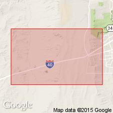
Pg. 15 (fig. 2), 21 (fig. 6), 27. Rio Puerco Member of Ceja Formation of Santa Fe Group. Gravelly sand. [Caps low escarpment, the Ceja del Rio Puerco, west of Albuquerque and north of I-40, in Bernalillo and Sandoval Counties, north-central New Mexico.] Contains petrocalcic soils of the Llano de Albuquerque geomorphic surface. Overlies Atrisco Member of Ceja Formation. Age is latest Pliocene (latest Blancan); Pliocene-Pleistocene boundary = 1.8 Ma. [ca. 2010 Pliocene-Pleistocene boundary = 2.5 Ma; Rio Puerco Member and upper part of Atrisco Member are Pleistocene (see p. 21, fig. 6).]
Type section (Ceja Formation): El Rincon section, from UTM (zone 13 S., NAD 83) 329, 425 m E.; 3,884,250 m N. (top) to 327, 394 m E.; 3,882, 052 m N. (base), [approx. Lat. 35 deg. 05 min. 12 sec. N., Long. 106 deg. 52 min. 16 sec. W. to Lat. 35 deg. 04 min. 00 sec. N., Long. 106 deg. 53 min. 35 sec. W.], in La Mesita Negra and La Mesita Negra SE 7.5-min quadrangles, Bernalillo Co., north-central NM. Named from Rio Puerco, a major tributary to the Rio Grande.
Type section (Ceja Formation): El Rincon section, base of section UTM Zone 13s, NAD83, 327,394 m E., 3,882,052 m N., top of section 329,425 m E., 3,884,250 m N., [approx. Lat. 35 deg. 04 min. 00 sec. N., Long. 106 deg. 53 min. 35 sec. W. to Lat. 35 deg. 05 min. 12 sec. N., Long. 106 deg. 52 min. 16 sec. W.], La Mesita Negra and La Mesita Negra SE 7.5-min quadrangles, Bernalillo Co., north-central NM. Named from Rio Puerco, a major tributary to the Rio Grande.
Source: Publication.
For more information, please contact Nancy Stamm, Geologic Names Committee Secretary.
Asterisk (*) indicates published by U.S. Geological Survey authors.
"No current usage" (†) implies that a name has been abandoned or has fallen into disuse. Former usage and, if known, replacement name given in parentheses ( ).
Slash (/) indicates name conflicts with nomenclatural guidelines (CSN, 1933; ACSN, 1961, 1970; NACSN, 1983, 2005, 2021). May be explained within brackets ([ ]).