

- Usage in publication:
-
- Rio Grande gravels
- Modifications:
-
- Original reference
- Dominant lithology:
-
- Gravel
- AAPG geologic province:
-
- Estancia basin
Summary:
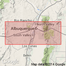
Pg. 26-43. Rio Grande gravels. [Name applied to middle part of Rio Grande series.] Gravel and rounded sands, 2 to 20+ feet thick, evidently the debris from the metamorphic series. [Age is late Tertiary.]
[Notable exposures in environs of Albuquerque, central northern NM.]
Source: US geologic names lexicons (USGS Bull. 896, Rio Grande series entry p. 1816-1817).
- Usage in publication:
-
- Rio Grande beds†
- Modifications:
-
- Abandoned
Summary:
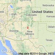
Rio Grande beds, which outcrop near Albuquerque, NM here abandoned; Santa Fe formation should be used instead. Santa Fe marls of Hayden (1869) redescribed as Santa Fe formation, extended and applied loosely to any deformed and partly consolidated alluvial beds of probable Tertiary age, and divided into "Lower Gray", "Middle Red", and "Upper Buff" members in this report. Santa Fe is areally extended into the report area--Ceja del Rio Puerco, a low escarpment west of the triangular highland known as Llano de Albuquerque, between the Rio Puerco and Rio Grande in Bernalillo and Valencia Cos, NM, Estancia and San Juan basins. Basis for extending Santa Fe rests on two lines of evidence: 1) fossil evidence of equivalent age (fossils were collected by various workers, especially Frick (1918); this fauna is now generally considered to be of late Miocene or early Pliocene age, refining Hayden's age of late Tertiary); and 2) continuity of slightly dissimilar and deformed alluvial deposits extending from the city of Santa Fe southwestward to this area. Generalized geologic map.
Source: GNU records (USGS DDS-6; Denver GNULEX).
For more information, please contact Nancy Stamm, Geologic Names Committee Secretary.
Asterisk (*) indicates published by U.S. Geological Survey authors.
"No current usage" (†) implies that a name has been abandoned or has fallen into disuse. Former usage and, if known, replacement name given in parentheses ( ).
Slash (/) indicates name conflicts with nomenclatural guidelines (CSN, 1933; ACSN, 1961, 1970; NACSN, 1983, 2005, 2021). May be explained within brackets ([ ]).