The National Geologic Map Database is migrating to a new infrastructure. We apologize for any service disruptions during this process.
|
|---|


- Usage in publication:
-
- Rio Bonito Member
- Modifications:
-
- Named
- Dominant lithology:
-
- Dolomite
- Limestone
- Sandstone
- AAPG geologic province:
-
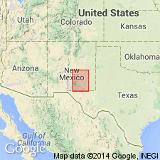
- Orogrande basin
Summary:
Named from the Rio Bonito, Lincoln Co, NM. Is basal of 3 newly named members of San Andres Formation (revised). Type locality is Sunset section, sec 20, T11S, R19E, Lincoln Co, NM, Orogrande basin. Crops out prominently in walls of numerous canyons that dissect the Pecos slope. Consists of mostly thick-bedded dolomite, although thin- and medium-bedded sequences are common. Bedding commonly changes along an exposure from thin to thick. Commonly light-gray and gray sequences alternate, causing banded exposures along canyon walls. Generally the lower 50-70 percent of the section consists of lighter gray and gray-brown tints than the upper part. Beds are mostly 2-6 ft thick, but are locally as much as 30 ft thick, and parallel (local lenticularity and rare cross-bedding). Thickens to south. Dolomite increases from south to north at the expense of limestone. Fossils or fossil fragments fairly common, but sporadically developed (fusulinids, brachiopods, ammonites). One or two tongues of Glorieta sandstone occur in lower part of Rio Bonito throughout central and southern parts of the area. Thickening of the Glorieta is at the expense of Rio Bonito--the Glorieta of north-central NM and Rio Bonito are facies of each other. Overlies Yeso Formation; overlain by Bonney Canyon Member (new) of San Andres. Permian (Leonardian) age. Measured sections. Geologic map.
Source: GNU records (USGS DDS-6; Denver GNULEX).
For more information, please contact Nancy Stamm, Geologic Names Committee Secretary.
Asterisk (*) indicates published by U.S. Geological Survey authors.
"No current usage" (†) implies that a name has been abandoned or has fallen into disuse. Former usage and, if known, replacement name given in parentheses ( ).
Slash (/) indicates name conflicts with nomenclatural guidelines (CSN, 1933; ACSN, 1961, 1970; NACSN, 1983, 2005, 2021). May be explained within brackets ([ ]).