The National Geologic Map Database is migrating to a new infrastructure. We apologize for any service disruptions during this process.
|
|---|


- Usage in publication:
-
- Rinconada schist
- Modifications:
-
- Original reference
- Dominant lithology:
-
- Schist
- Quartzite
- AAPG geologic province:
-
- Southern Rocky Mountain region
Summary:
Pg. 13 (table 1), 22, pl. 2. Rinconada schist phase in Ortega quartzite. Consists of gray to buff quartz-muscovite schist, which in many places has interbedded quartzite members. Most of the schist is more or less even textured. Some is conglomeratic. In one area, it directly overlies Hopewell series (new). [Age is Precambrian (Proterozoic).]
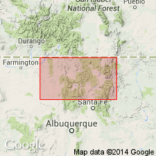
Occurs in Picuris Mountain area, Taos Co., central northern NM [west of Rinconada, in Rio Arriba Co., Carson National Forest area, central northern NM; see pl. 2].
Source: US geologic names lexicon (USGS Bull. 1200, p. 3277).
- Usage in publication:
-
- Rinconada schist member
- Modifications:
-
- Revised
- Redescribed
- Dominant lithology:
-
- Gneiss
- Schist
- Quartzite
- Phyllite
- AAPG geologic province:
-
- Southern Rocky Mountain region
Summary:
Pg. 6, 8 (fig. 2), 12-19, pl. 1. Rinconada schist member of Ortega quartzite. Consists of four distinctive and mappable units: andalusite-biotite hornfels, staurolite gneiss and schist, quartzite, and muscovite-quartz-biotite-garnet phyllite. Total thickness estimated to be 1,800 feet. Lies between a lower quartzite member and the upper Pilar phyllite member (new). [Age is Precambrian (Proterozoic).] Origin of name given.
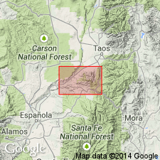
Named from settlement of Rinconada 2 mi north of Dixon in the Rio Grande Canyon, [Canon del Rio Grande, Velarde 7.5-min quadrangle, Rio Arriba Co., Carson National Forest area, central northern NM].
Source: US geologic names lexicon (USGS Bull. 1200, p. 3277).
- Usage in publication:
-
- Rinconada Schist Member
- Modifications:
-
- Redescribed
- Dominant lithology:
-
- Schist
- Gneiss
- Quartzite
- Phyllite
- AAPG geologic province:
-
- Southern Rocky Mountain region
Summary:
Rinconada Schist Member of Ortega Formation here redescribed. Rinconada defined for Picuris Range by Montgomery (1953) and there includes 4 distinctive units: andalusite-biotite hornfels (better termed a gneiss); staurolite-rich schist and gneiss intercalated locally with thin quartzite beds; quartzite; muscovite-quartz-biotite-garnet phyllite. In this report lithologic description simplified from 4 units to 3 (even though all 4 found in certain sections of Truchas area). In Truchas area, Rio Arriba Co, NM, Southern Rocky Mountain region, andalusite-biotite gneiss appears in such spotty and discontinuous outcrops that it is impossible to map this bed as a separate unit or to be sure of a characteristic mineral composition for it because of differential metamorphism along the strike. Redescribed as follows: 1) a lower series of beds of staurolite-rich schist and gneiss intercalated locally with thin quartzite beds; 2) a thick bed of discontinuous quartzite; and 3) an uppermost series of beds of muscovite-biotite phyllite. Latter unit is characterized especially by its fine-grained texture, its carbonaceous nature near top, and its gradation upward into overlying, black, slaty, carbonaceous Pilar Phyllite Member of Ortega. One exceptional exposure northwest of Pecos Baldy in Truchas area contains all 4 units of Rinconada precisely as found in northern Picuris Range. Precambrian age. Geologic map.
Source: GNU records (USGS DDS-6; Denver GNULEX).
- Usage in publication:
-
- Rinconada Formation
- Modifications:
-
- Principal reference
- Revised
- Reference
- AAPG geologic province:
-
- Southern Rocky Mountain region
Summary:
Pg. 46 (table 1), 50-51. Rinconado Formation of Hondo Group. Recognized in the Picuris Mountains of central northern New Mexico. Lies below Pilar Formation and above Ortega Formation (both of Hondo Group). Age is considered Early Proterozoic, younger than 1,700 Ma.
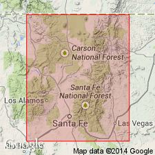
Principal reference section (Hondo Group): Hondo Canyon area, in secs. 29 and 32, T. 24 N., R. 12 E., Taos SW 7.5-min quadrangle, Taos Co., northern Picuris Mountains, [Carson National Forest area], central northern NM.
Reference section: in Rattlesnake Canyon south of Copper Hill, southern Picuris Mountains, near bdry. btw. secs. 19 and 20, T. 23 N., R. 11 E., Trampas 7.5-min quadrangle, [Taos Co., Carson National Forest area], central northern NM.
Source: Modified from GNU records (USGS DDS-6; Denver GNULEX).
For more information, please contact Nancy Stamm, Geologic Names Committee Secretary.
Asterisk (*) indicates published by U.S. Geological Survey authors.
"No current usage" (†) implies that a name has been abandoned or has fallen into disuse. Former usage and, if known, replacement name given in parentheses ( ).
Slash (/) indicates name conflicts with nomenclatural guidelines (CSN, 1933; ACSN, 1961, 1970; NACSN, 1983, 2005, 2021). May be explained within brackets ([ ]).