- Usage in publication:
-
- Rincon Ridge Metamorphics
- Modifications:
-
- First used
- Dominant lithology:
-
- Schist
- Quartzite
- AAPG geologic province:
-
- Southern Rocky Mountain region
- Southwestern Basin-and-Range region
Summary:
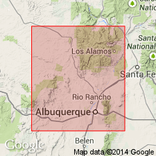
First published use as a name for some resistant quartzite and quartz-mica schist exposed on Rincon Ridge in the Sandia Mountains. Thought to be 7,000+ ft thick. Is 75 to 80 percent quartzite. Feldspar and sillimanite schist occurs near contact with Sandia Granite. Some greenstone and chlorite schist occurs in patches in T12N, R4E. Mapped (geologic map) as [all or part of?] a "mica schist" unit [term Rincon Ridge Metamorphics not used on map] along Rincon Ridge west side of area in Bernalillo (Southwestern Basin-and-Range region) and Sandoval (Southern Rocky Mountain region) Cos, NM. Small outliers exposed at base of Montezuma Mountain in San Antonio de Las Huertas Grant in Sandoval Co. Is in contact on the ridge with Quaternary rocks to west and with Sandia Granite (first used) to east. Precambrian age.
Source: GNU records (USGS DDS-6; Denver GNULEX).
For more information, please contact Nancy Stamm, Geologic Names Committee Secretary.
Asterisk (*) indicates published by U.S. Geological Survey authors.
"No current usage" (†) implies that a name has been abandoned or has fallen into disuse. Former usage and, if known, replacement name given in parentheses ( ).
Slash (/) indicates name conflicts with nomenclatural guidelines (CSN, 1933; ACSN, 1961, 1970; NACSN, 1983, 2005, 2021). May be explained within brackets ([ ]).

