The National Geologic Map Database is migrating to a new infrastructure. We apologize for any service disruptions during this process.
|
|---|


- Usage in publication:
-
- Riggins Mill Member
- Modifications:
-
- Named
- Dominant lithology:
-
- Sand
- Limestone
- AAPG geologic province:
-
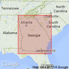
- South Georgia sedimentary province
Summary:
Riggins Mill Member named at base of Clinchfield Formation of Barnwell Group. Consists of grayish-yellow to pale-yellow, unconsolidated, concretionary, and fossiliferous sand, and limestone. 4.1 m thick at type locality. Ranges from 0 to 5.2 m. Overlies Huber Formation; gradationally underlies Treadwell Member of Clinchfield and grades laterally into undivided weathered and leached Clinchfield Formation. [Though unit was actually formally named in 1985 Georgia Bulletin 95 by same authors, unit was annotated from this publication for USGS Bulletin 1564 (Lexicon).]
Source: GNU records (USGS DDS-6; Reston GNULEX).
- Usage in publication:
-
- Riggins Mill Member
- Modifications:
-
- Overview
- Areal extent
- AAPG geologic province:
-
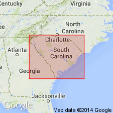
- Atlantic Coast basin
Summary:
In the study area, Siple (1967) assigned the lower part of the upper Eocene to the McBean Formation and the upper part to the Barnwell and Hawthorn formations. Authors here follow the stratigraphic terminology of Huddlestun and Hetrick (1985) for the upper Eocene. The basal upper Eocene unit is the Clinchfield Formation, which consists of glauconitic, biomoldic limestone, calcareous sand and clay, and tan and yellow quartz sand. The quartz sand is probably the Riggins Mill Member, and the calcareous part is the Utley Limestone Member. The lower contact of the Clinchfield with the middle Eocene Santee Limestone is probably unconformable. The Clinchfield is about 25 ft thick in the southeastern part of the Site and pinches out or becomes unrecognizable in the center of the Savannah River Site. Thickness for Riggins Mill not given. Clinchfield appears to correlate biostratigraphically with the Gosport or Moodys Branch Formation of the Gulf Coastal Plain.
Source: GNU records (USGS DDS-6; Reston GNULEX).
For more information, please contact Nancy Stamm, Geologic Names Committee Secretary.
Asterisk (*) indicates published by U.S. Geological Survey authors.
"No current usage" (†) implies that a name has been abandoned or has fallen into disuse. Former usage and, if known, replacement name given in parentheses ( ).
Slash (/) indicates name conflicts with nomenclatural guidelines (CSN, 1933; ACSN, 1961, 1970; NACSN, 1983, 2005, 2021). May be explained within brackets ([ ]).