

- Usage in publication:
-
- Rierdon formation
- Modifications:
-
- Named
- Dominant lithology:
-
- Shale
- AAPG geologic province:
-
- Sweetgrass arch
- Montana folded belt
Summary:
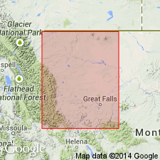
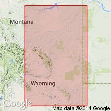
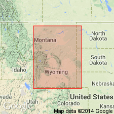
Named as middle formation of Ellis group for exposures in Rierdon Gulch in sec 23, T24N, R9W (type locality), Teton Co, MT, Sweetgrass arch where a section 137 ft thick measured. Is 140 ft thick at Swift Reservoir (T28N, R10W). Is absent at Belt Creek section (Ts17 and 18N, R6E). Four subsurface sections described (Pondera, North- and South-Cut Bank, and Kevin-Sunburst Dome). Thickens west to more than 200 ft. Isopach map. Occurs in Liberty, Chouteau, Toole, Pondera, Glacier, Teton Cos, MT on the Sweetgrass arch and into Lewis and Clark Co, MT, Montana folded belt province. [Extent to south and east beyond Sweetgrass arch not shown.] Absent over most of South arch. Consists of medium- to dark gray, chunky to fissile, calcareous to noncalcareous shale containing gray, dense limestone as nodules and as thin beds. Divisible into a basal medium gray, limy chunky shale, medial dark gray, fissile, slightly calcareous to noncalcareous shale, and upper medium gray, limy chunky shale. All three parts have nodular limestone. Barite concretions up to 10" diameter occur in middle third. Weathers to steep slope. Outcrop banded by hard limestone layers. Overlies Sawtooth formation (new) of Ellis. Underlies Swift formation (new) of Ellis. Abundant fossils (p. 1280). A late Bathonian and early Callovian, or Middle and Late Jurassic age.
Source: GNU records (USGS DDS-6; Denver GNULEX).
- Usage in publication:
-
- Rierdon formation*
- Modifications:
-
- Revised
- Areal extent
- Biostratigraphic dating
- AAPG geologic province:
-
- Central Montana uplift
- Williston basin
- Sweetgrass arch
- Powder River basin
- Bighorn basin
Summary:
Described and correlated in measured sections in north-central, central, and south-central MT. Consists mainly of calcareous gray shale and gray limestone. Overlies Piper formation (new) with an abrupt but apparently conformable contact. Contact with overlying Swift formation sharp and disconformable. Discusses faunas and basis for dating. Age Late Jurassic (lower Callovian) on the basis of its ammonites.
Source: GNU records (USGS DDS-6; Denver GNULEX).
- Usage in publication:
-
- Rierdon formation
- Modifications:
-
- Biostratigraphic dating
- AAPG geologic province:
-
- Powder River basin
- Williston basin
- Chadron arch
Summary:
Describes FORAMINIFERA from 7 localities in MT, WY, ND, and SD in the Powder River and Williston basins and on the Chadron arch. Collected from Rierdon formation in MT, from the Stockade Beaver shale member of the Sundance formation in WY and SD, and from Sundance formation in ND.
Source: GNU records (USGS DDS-6; Denver GNULEX).
- Usage in publication:
-
- Rierdon unit
- Modifications:
-
- Overview
- AAPG geologic province:
-
- Williston basin
- Powder River basin
- Central Montana uplift
- Sweetgrass arch
- Bighorn basin
- Wind River basin
- Montana folded belt
Summary:
Defined as: Rierdon formation in central MT, and the lithologically equivalent part of Sundance formation in Saskatchewan, Manitoba, eastern MT and ND; Canyon Springs, Stockade Beaver, and Hulett members of Sundance formation in the Black Hills, WY and SD; the "lower Sundance" formation in WY, excluding the so-called upper "red zone"; upper part of Twin Creek limestone in western WY and eastern ID. Shows correlation, thickness, and lithofacies, and makes tectonic and environmental interpretations. Underlain conformably at most places by Piper unit; overlain unconformably by Swift unit. Is Late Jurassic (Callovian) in age.
Source: GNU records (USGS DDS-6; Denver GNULEX).
- Usage in publication:
-
- Rierdon formation
- Modifications:
-
- Biostratigraphic dating
- AAPG geologic province:
-
- Central Montana uplift
- Powder River basin
- Williston basin
- Chadron arch
- Bighorn basin
- Wind River basin
- Montana folded belt
Summary:
Describes 22 species of Upper [Late] Jurassic (Callovian) OSTRACODA, collected from outcrops at 21 localities in MT, WY, and SD. Concludes that the "Upper Sundance"--Swift (Oxfordian) OSTRACODA assemblage is distinctly different from the "Lower Sundance"--Rierdon assemblage, and that the "Lower Sundance" assemblage of eastern WY and the Black Hills is markedly different from that of the Rierdon formation in MT.
Source: GNU records (USGS DDS-6; Denver GNULEX).
- Usage in publication:
-
- Rierdon formation
- Modifications:
-
- Revised
- Areal extent
- Overview
- AAPG geologic province:
-
- Williston basin
- Powder River basin
- Chadron arch
- Denver basin
Summary:
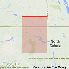
Extends name into eastern WY, southwestern SD, and northwestern NE [in Powder River basin, northwestern part of Chadron arch, and northern part of Denver basin]. Made the lower of two units in Sundance group [hereby raised in rank from Sundance formation]. In the Black Hills and vicinity, includes (ascending): Canyon Springs, Stockade Beaver, Hulett, and Lak members. Is the "lower Sundance" of some authors in eastern WY. Overlain disconformably by Swift formation; overlies disconformably Gypsum Spring formation, or Triassic rocks of Spearfish or Chugwater formations. Contains two distinct ostracode biofacies whose distribution is apparently governed by environmental factors associated with the presence of the Sheridan arch [a northwest-trending feature in northeastern WY and southeastern MT]. Gives restored isopach map for Rierdon formation and equivalent rocks in WY, eastern MT, and bordering parts of ND, SD, and NE. Is Late Jurassic (Callovian) in age.
Source: GNU records (USGS DDS-6; Denver GNULEX).
- Usage in publication:
-
- Rierdon formation
- Modifications:
-
- Areal extent
- Overview
- AAPG geologic province:
-
- Williston basin
Summary:
Used name and shows correlation in the western part of the Williston basin. Equivalent rocks included in Sundance formation in the eastern part of the basin. Overlain by Swift formation with no evidence of unconformity in the central part of the basin; underlain by Piper formation, probably conformably. Is Late Jurassic in age. [Additional details in Francis, D. R., 1957, American Association of Petroleum Geologists Bulletin, v. 41, no. 3, p. 372-374 (figs. 2-4, p. 379 (table 1), p. 387.]
Source: GNU records (USGS DDS-6; Denver GNULEX).
- Usage in publication:
-
- Rierdon formation
- Modifications:
-
- Overview
- AAPG geologic province:
-
- Williston basin
- Powder River basin
- Central Montana uplift
- Sweetgrass arch
- Bighorn basin
- Montana folded belt
Summary:
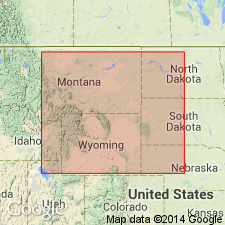
Consists of three main marine lithogenetic units within the Williston basin and most of the Montana shelf. These are designated (ascending): Rierdon "A", "B", and "C" corresponding to a lower calcareous member [shale and limestone], a middle shale member, and an upper sandy member, middle formation in the Ellis group. Shows correlations in well logs and surface section in central and eastern MT, western ND, northwestern SD, and north-central WY. Discusses paleogeography and depositional environments of the three units and their equivalents in the northern Rocky Mountains and Great Plains. Reviews basis for dating. Late Jurassic (Callovian) in age.
Source: GNU records (USGS DDS-6; Denver GNULEX).

- Usage in publication:
-
- Rierdon Formation*
- Modifications:
-
- Age modified
- Overview
- AAPG geologic province:
-
- Williston basin
- Montana folded belt
- Central Montana uplift
- Sweetgrass arch
Summary:
Is the middle formation of the Ellis Group [term not mentioned in this report]. Correlation chart shows formation at Utica on the Judith River, Sweetgrass arch, Lewiston, Fergus Co, Central Montana uplift, east into the MT plains, Williston basin in the subsurface and north into Saskatchewan subsurface, CN where it is the basal formation of the Vanguard Group. Occurs widely throughout MT and ND, except on Belt Island. Is up to 185 ft thick at surface and about 350 ft thick in subsurface. A basal unit in southern MT is an oolitic limestone a few inches to 30 ft thick that represents the northern edge of the Canyon Springs Sandstone Member of the Sundance Formation. An oolitic to sandy limestone at the top represents the northern extension of the Hulett Sandstone Member of the Sundance. Of early to early late Bathonian and early Callovian, Middle Jurassic age. Callovian was included in the Late Jurassic in earlier papers. Paleogeography of Middle Jurassic time described. Large correlation charts.
Source: GNU records (USGS DDS-6; Denver GNULEX).
- Usage in publication:
-
- Rierdon Limestone*
- Modifications:
-
- Overview
- Redescribed
- Dominant lithology:
-
- Limestone
- AAPG geologic province:
-
- Montana folded belt
Summary:
Redescribed to more appropriate lithic rank term; has been commonly referred to by previous workers as Rierdon Formation. Described as thin-to thick-bedded, yellowish-gray to brownish-gray, fine-grained, oolitic limestone; contains few limy siltstone interbeds. Rierdon is middle of three formations of Ellis Group; only Rierdon is separately mapped and only in some places. Well exposed in unnamed canyon 1 km south of Shell Creek, Madison Co, MT, Montana folded belt province. Forms ledges. Bivalves CAMTOMECTES and GRYPHAEA are locally abundant. About 8-30 m thick. Conformably overlies Sawtooth Formation of Ellis; unconformably underlies Swift Sandstone of Ellis. Middle Jurassic age.
Source: GNU records (USGS DDS-6; Denver GNULEX).
For more information, please contact Nancy Stamm, Geologic Names Committee Secretary.
Asterisk (*) indicates published by U.S. Geological Survey authors.
"No current usage" (†) implies that a name has been abandoned or has fallen into disuse. Former usage and, if known, replacement name given in parentheses ( ).
Slash (/) indicates name conflicts with nomenclatural guidelines (CSN, 1933; ACSN, 1961, 1970; NACSN, 1983, 2005, 2021). May be explained within brackets ([ ]).