- Usage in publication:
-
- Riddle formation*
- Modifications:
-
- Original reference
- Dominant lithology:
-
- Siltstone
- AAPG geologic province:
-
- Western Columbia basin
Summary:
Pg. 2774-2782. Riddle formation. Introduced for clastic sedimentary rocks of Late Jurassic (Portlandian) age in southwestern Oregon. Consists mostly of medium- to dark-gray siltstone in which pebble lenses are common. Where well exposed, divisible into two members: [1] a lower, of medium- to dark-gray siltstone in which pebble lenses and limestone lenses are common, chert conglomerate locally at top; conglomerate and metavolcanics locally at base; and [2] an upper, dominantly medium-gray siltstone, sandstone beds fairly common; limestone lenses few; conglomerate of chert and graywacke common at top. Thickness about 1,088 feet. Underlies Days Creek formation (new) with probable disconformity; overlies Rogue formation near Days Creek and in valley of Myrtle Creek; overlies Dothan formation in Dutchman Butte, Roseburg, and Bone Mountain quadrangles. Name Riddle replaces Jurassic part of Knoxville formation as used by Diller and Kay (1924, USGS Geol. Atlas, Folio No. 218) in southwestern Oregon.
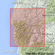
Type section: about 10 mi east of Riddle along South Umpqua River from 0.5 to 1 mi above mouth of Days Creek in E/2 sec. 16 and W/2 sec. 15, T. 30 N., R. 4 W., Douglas Co., southwestern OR. Named from town of Riddle. Well exposed in valley of South Umpqua River and its tributaries, Days Creek, Cow Creek, and Myrtle Creek, in Days Creek, Canyonville, Roseburg, and Dutchman Butte quadrangles.
Source: US geologic names lexicon (USGS Bull. 1200, p. 3268-3269).
For more information, please contact Nancy Stamm, Geologic Names Committee Secretary.
Asterisk (*) indicates published by U.S. Geological Survey authors.
"No current usage" (†) implies that a name has been abandoned or has fallen into disuse. Former usage and, if known, replacement name given in parentheses ( ).
Slash (/) indicates name conflicts with nomenclatural guidelines (CSN, 1933; ACSN, 1961, 1970; NACSN, 1983, 2005, 2021). May be explained within brackets ([ ]).

