

- Usage in publication:
-
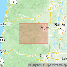
- Rickreall Limestone Member
- Modifications:
-
- Original reference
- Dominant lithology:
-
- Limestone
- AAPG geologic province:
-
- Western Columbia basin
Summary:
Pg. 19-21, geol. map. Rickreall Limestone Member of Yamhill Formation. A lens of impure limestone near base of formation. Thickness 60 to 80 feet. Has been referred to as "Dallas limestone" by many workers. Age is Eocene.
Type locality not stated. Well exposed in quarry of Oregon Portland Cement Company, and to lesser extent in quarry on property owned by T.T. Leonard in NW/4 sec. 12, T. 8 S., R. 6 W. Named from Rickreall Creek near Dallas, western OR.
[Misprint: US geologic names lexicon (USGS Bull. 1350, p. 631) states unit is present in eastern Oregon. Unit is present in western Oregon.]
Source: US geologic names lexicon (USGS Bull. 1350, p. 631).
For more information, please contact Nancy Stamm, Geologic Names Committee Secretary.
Asterisk (*) indicates published by U.S. Geological Survey authors.
"No current usage" (†) implies that a name has been abandoned or has fallen into disuse. Former usage and, if known, replacement name given in parentheses ( ).
Slash (/) indicates name conflicts with nomenclatural guidelines (CSN, 1933; ACSN, 1961, 1970; NACSN, 1983, 2005, 2021). May be explained within brackets ([ ]).