The National Geologic Map Database is migrating to a new infrastructure. We apologize for any service disruptions during this process.
|
|---|


- Usage in publication:
-
- Rhyolite Canyon series
- Modifications:
-
- Original reference
- Dominant lithology:
-
- Rhyolite
- AAPG geologic province:
-
- Pedregosa basin
Summary:
Pg. 105-107. Rhyolite Canyon series. Volcanic sequence made up of rhyolite flows and tuffs. Composite thickness of 1,025 to 1,405 feet. Underlies Sugarloaf series (new); unconformably overlies Faraway Ranch series (new). Age is Cenozoic.
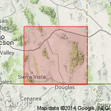
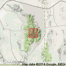
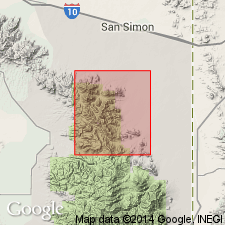
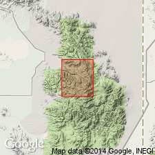
Best exposed in Rhyolite Canyon from which it is named, Chiricahua National Monument, Cochise Co., southeastern AZ.
Source: US geologic names lexicon (USGS Bull. 1200, p. 3257); supplemental information from GNU records (USGS DDS-6; Denver GNULEX).
- Usage in publication:
-
- Rhyolite Canyon formation
- Modifications:
-
- Revised
- AAPG geologic province:
-
- Pedregosa basin
Summary:
Pg. 1218-1236, pl. 1 (geol. map). Rhyolite Canyon formation. Referred to as a formation. Most of the rhyolite deposits of Cenozoic age in Chiricahua National Monument, heretofore termed flows, are more correctly classified as welded rhyolite tuff or ignimbrite, the result of many eruptions of nuess ardentes. Beds of formation are pale brown to pinkish gray, darkening to pale brown or grayish red on exposure. All are porphyritic containing phenocrysts of quartz and sanidine. Consists of nine unnamed members of which all but the uppermost member are rhyolites. Upper member of black to medium-dark-gray rhyodacite. Thickness 1,900 feet. [Presumably includes rocks described as Sugarloaf series (Enlows, 1951).] Unconformably overlies Faraway Ranch formation. Traced southward into main portion of Chiricahua Mountains, and apparently crops out all along central and western parts of range, extending eastward into Portal area. Raydon (unpub. thesis) named 4,500 feet of rhyolite tuffs and welded tuffs which cap section in Cave Creek area, the Cave Creek formation, and states they are probably correlative with those of Chiricahua National Monument. Age is Cenozoic.
Source: US geologic names lexicon (USGS Bull. 1200, p. 3257).
- Usage in publication:
-
- Rhyolite Canyon Formation
- Modifications:
-
- Geochronologic dating
- AAPG geologic province:
-
- Pedregosa basin
Summary:
Table 8. K-Ar age 16.2 Ma.
Source: Modified from GNU records (USGS DDS-6; Denver GNULEX).
- Usage in publication:
-
- Rhyolite Canyon Formation*
- Modifications:
-
- Adopted
- AAPG geologic province:
-
- Pedregosa basin
Summary:
Pg. A12-A14. Rhyolite Canyon Formation of Enlows (1951, 1955) adopted by the USGS. Recognized in Chiricahua Mountains area, Cochise County, southeastern Arizona. Thickness up to 2,000 feet. Overlies unnamed lower rhyolite volcanic rocks of Oligocene and Miocene(?) age; underlies unnamed upper rhyolite volcanic rocks of Miocene age; intruded by unnamed monzonite and latite complex of Miocene age. Age is early Miocene (K-Ar age of 24.2 to 25.0 Ma, citing Fernandez and Enlows, 1966, GSA Bull., v. 77, no. 9, p. 1017-1030, and Marjaniemi, 1969, Tucson, Arizona Univ. PhD dissert., 176 p.).
Source: Publication; Changes in stratigraphic nomenclature, 1973 (USGS Bull. 1395-A, p. A34-A35).
- Usage in publication:
-
- Rhyolite Canyon Formation*
- Modifications:
-
- Revised
- AAPG geologic province:
-
- Pedregosa basin
Summary:
Rhyolite Canyon Formation. Rhyolitic volcanic rocks, chiefly ash-flow deposits, derived from a source caldera(?) to the south-southeast [of study area] in central part of Chiricahua Mountains, Cochise County, southeastern Arizona. Subdivided into seven informal members. Enlows' (1955) members 1 and 2 are considered lateral facies; his member 5 is not mappable at a common mapping scale and may reflect an origin other than that of primary tuff deposition; his member 9, found only on Sugarloaf Mountain, reflects a part of geologic history different from that of the other members and may not be a part of the Rhyolite Canyon Formation. Disconformably overlies Faraway Ranch Formation. Age is Miocene. K-Ar ages of 25.6 +/-0.8 Ma, 25.4 +/-0.7 Ma, and 24.7 +/-0.7 Ma (Marvin and others, 1978, New Mexico Geol. Soc. Gdbk, no. 29, recalculation of dates given by Marjaniemi, 1968, Arizona Geol. Soc. Gdbk, no. 3).
Source: Publication.
- Usage in publication:
-
- Rhyolite Canyon Tuff*
- Modifications:
-
- Revised
- Age modified
- Geochronologic dating
- Dominant lithology:
-
- Tuff
- AAPG geologic province:
-
- Pedregosa basin
Summary:
Rhyolite Canyon Tuff. Quartz-sanidine rhyolite ash-flow tuff; erupted from Turkey Creek caldera. Subdivided into intracaldera and outflow facies. Outflow facies includes Enlows' (1955) informal members (ascending) 3 to 8; his member 2 = underlying Jesse James Canyon Tuff (new) and his member 9 = overlying dacite of Sugarloaf Mountain of Drewes (1982). Enlows' member 1, recognized near Picket Park, may be distal edge of basal Rhyolite Canyon (restricted). Age is Oligocene, based on 40Ar/39Ar ages of 26.94 +/-0.16 Ma (lower member of outflow facies) and 26.93 +/-0.12 Ma (upper member of outflow facies).
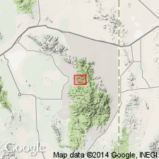
Type area: in Chiricahua National Monument, Cochise Co., southeastern AZ.
Source: Publication.
For more information, please contact Nancy Stamm, Geologic Names Committee Secretary.
Asterisk (*) indicates published by U.S. Geological Survey authors.
"No current usage" (†) implies that a name has been abandoned or has fallen into disuse. Former usage and, if known, replacement name given in parentheses ( ).
Slash (/) indicates name conflicts with nomenclatural guidelines (CSN, 1933; ACSN, 1961, 1970; NACSN, 1983, 2005, 2021). May be explained within brackets ([ ]).